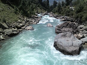
Nallah Sindh
| Sind River/ﻧﺎﻟﮧ ﺳﻨﺪﮪ | |
| River | |
|
Sind River
|
|
| Country | India |
|---|---|
| State | Jammu and Kashmir |
| Region | Kashmir Valley |
| District | Ganderbal |
| Source | 34°12′14.860″N 75°35′21.94″E / 34.20412778°N 75.5894278°ECoordinates: 34°12′14.860″N 75°35′21.94″E / 34.20412778°N 75.5894278°E |
| - location | Machoi Glacier |
| - elevation | 4,800 m (15,748 ft) |
| Mouth | 34°11′2.382″N 74°40′36.21″E / 34.18399500°N 74.6767250°E |
| - location | Jehlum river at Shadipora |
| - elevation | 1,600 m (5,249 ft) |
| Length | 108 km (67 mi) |
| Discharge | |
| - average | 290 m3/s (10,241 cu ft/s) |
The Sind River or the Sindh River Urdu: سندھ ندی Kashmiri: سیندھ is a river in the Ganderbal district of Jammu and Kashmir state of India. It is a major tributary of the Jehlum River and is 108 kilometres long.
The Sind River forms the Sind Valley. The source of the river lies in Machoi Glacier at an elevation of 4800 metres, east of Amarnath temple south of Zojila pass. It flows through Panjtarni (a camping site of Amarnath yatra) southwards up to Domail where it joins a tributary which doubles its flow from Kolhoi Glacier. It flows mostly westwards along with NH 1D and is fed by many glacial streams on its way to Ganderbal town. At Kichpora Preng it is fed by Wangath river which flows down from the Gangabal Lake. The major tributaries of the river are:
It is navigable from Ganderbal town onwards as the waterflow slows down. It joins the Jehlum River at Shadipora. 17 kilometres northwest from Srinagar city. The Sind River passes through a famous alpine hill station Sonamarg where river rafting tournaments on the river are being organised yearly by the Tourism Department of Jammu and Kashmir. It is the only river in Jammu and Kashmir on which three hydroelectric power plants are functional. The waters of the river are used for irrigation by way of different canals and for domestic use after going through water treatment plants.
...
Wikipedia

