Moses-Saunders Power Dam
| Moses-Saunders Power Dam | |
|---|---|

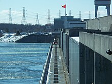
The dam's R.H. Saunders Generating Station
|
|
|
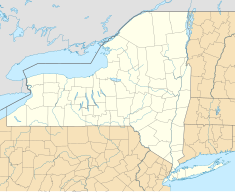
Location of Moses-Saunders Power Dam in New York
|
|
| Official name | Robert Moses-Robert H. Saunders Power Dam |
| Country | United States/Canada |
| Location |
Massena, New York Cornwall, Ontario |
| Coordinates | 45°00′23″N 74°47′42″W / 45.00639°N 74.79500°WCoordinates: 45°00′23″N 74°47′42″W / 45.00639°N 74.79500°W |
| Status | Operational |
| Construction began | 1954 |
| Opening date | 1958 |
| Owner(s) |
New York Power Authority Ontario Hydro |
| Dam and spillways | |
| Impounds | Saint Lawrence River |
| Height | 195.5 ft (60 m) |
| Length | 3,216 ft (980 m) |
| Spillways | Long Sault Dam |
| Reservoir | |
| Creates | Lake St. Lawrence |
| Surface area | 100 sq mi (259 km2) |
| Maximum length | 30 mi (48 km) |
| Power station | |
| Commission date | R.H. Saunders: July 8, 1958-December 18, 1959 |
| Hydraulic head | 81 ft (25 m) |
| Turbines | R.H. Saunders: 16 x 65.3 MW fixed-pitch Kaplan-type St. Lawrence/FDR: 16 x 57 MW fixed pitch Kaplan-type |
| Installed capacity | R.H. Saunders: 1,045 MW St. Lawrence/FDR: 912 MW Total: 1,957 MW |
The Moses-Saunders Power Dam, short for Robert Moses-Robert H. Saunders Power Dam, is a dam on the Saint Lawrence River straddling the border between the United States and Canada. It is located between Massena in New York and Cornwall in Ontario. The dam supplies water to two adjacent power stations, the United States' 912 MW St. Lawrence-Franklin D. Roosevelt Power Project and Canada's 1,045 MW R.H. Saunders Generating Station. Constructed between 1954 and 1958, the dam created Lake St. Lawrence and is part of a larger project called the Saint Lawrence Seaway. Aside from providing significant amounts of renewable power, the dam regulates the St. Lawrence River and affords passage for the navigation of large vessels. Despite the enormous economic advantages to the dam, it required the relocation of 6,500 people and caused harm to the surrounding environment. Positive efforts have been made over the years to improve shoreline and fish habitats.
Development of the St. Lawrence River which serves as a border between Canada and the United States was in its early stages in 1871 when the Treaty of Washington was signed, which in part demarcated the St. Lawrence River as a boundary and offered Americans greater use of the Canadian side of the river for shipping. In 1895 the Deep Waterways Commission was established to explore expanded use of the river for navigation. International shipping on the river would have a positive impact on trade between the two countries. The early St. Lawrence Seaway was proposed but railway companies in the United States stopped its construction because they felt it would reduce their profits. The Boundary Waters Treaty of 1909 further solidified cooperation between the U.S. and Canada on the river, allowing "free and open" navigation and establishing the International Joint Commission (IJC) to resolve disputes. In 1931, New York's Governor Franklin D. Roosevelt signed the Power Authority Act which allowed the development of the St. Lawrence River for power use. A primary site was just below the Long Sault Rapids. Despite the cooperation, the U.S. Federal Government was unable to open up the river for increased navigation and development due to political issues. Upset with this, Canada unilaterally passed two acts in 1951 which allowed projects on the St. Lawrence for power and navigation purposes. They pressured the U.S. to act and in 1952, President Dwight D. Eisenhower approved a hydroelectric dam on the river. The next year a proposal for a hydroelectric dam and navigation lock was submitted to the IJC for approval. In October 1952 the project was approved.
...
Wikipedia

