Montgomery County, Virginia
| Montgomery County, Virginia | ||
|---|---|---|

Montgomery County Courthouse
|
||
|
||
| Motto: Freedom Increases Responsibility | ||
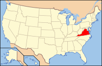
 Location in the U.S. state of Virginia |
||
 Virginia's location in the U.S. |
||
| Founded | 1772 | |
| Named for | Richard Montgomery | |
| Seat | Christiansburg | |
| Largest town | Blacksburg | |
| Area | ||
| • Total | 389 sq mi (1,008 km2) | |
| • Land | 387 sq mi (1,002 km2) | |
| • Water | 2.2 sq mi (6 km2), 0.6% | |
| Population (est.) | ||
| • (2015) | 97,653 | |
| • Density | 251/sq mi (97/km²) | |
| Congressional district | 9th | |
| Time zone | Eastern: UTC-5/-4 | |
| Website | www |
|
Montgomery County is a county located in the U.S. state of Virginia. As of the 2010 census, the population was 94,392. Its county seat is Christiansburg.
Montgomery County is part of the Blacksburg–Christiansburg–Radford, VA Metropolitan Statistical Area.
Montgomery County was established in 1777 from Fincastle County. The county is named for Richard Montgomery, an American Revolutionary War general killed in 1775 while attempting to capture Quebec City, Canada.
According to the U.S. Census Bureau, the county has a total area of 389 square miles (1,010 km2), of which 387 square miles (1,000 km2) is land and 2.2 square miles (5.7 km2) (0.6%) is water. The western part of the county is in the New River watershed.
As of the 2010 United States Census, there were 94,392 people residing in the county. 87.6% were White, 5.4% Asian, 3.9% Black or African American, 0.2% Native American, 0.8% of some other race and 2.1% of two or more races. 2.7% were Hispanic or Latino (of any race).
...
Wikipedia

