Monroe County, Michigan
| Monroe County, Michigan | ||
|---|---|---|

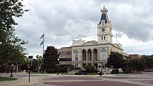
Monroe County Courthouse
|
||
|
||
 Location in the U.S. state of Michigan |
||
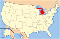
 Michigan's location in the U.S. |
||
| Founded | July 14, 1817 | |
| Named for | James Monroe | |
| Seat | Monroe | |
| Largest city | Monroe | |
| Area | ||
| • Total | 680 sq mi (1,761 km2) | |
| • Land | 549 sq mi (1,422 km2) | |
| • Water | 131 sq mi (339 km2), 19% | |
| Population | ||
| • (2010) | 152,021 | |
| • Density | 277/sq mi (107/km²) | |
| Congressional district | 7th | |
| Time zone | Eastern: UTC-5/-4 | |
| Website | www |
|
Monroe County is a county located in the U.S. state of Michigan. As of the 2010 census, the population was 152,021. The largest city and county seat is Monroe. The county was established as the second county (after Wayne County) in the Michigan Territory in 1817 and was named for then-President James Monroe.
Monroe County comprises the Monroe, MI Metropolitan Statistical Area and is included in the Detroit-Warren-Ann Arbor, MI Combined Statistical Area. It is unofficially considered a northerly extension of the Toledo Metropolitan Area.
Before the county’s formation, the primary settlement was Frenchtown, which was settled in as early as 1784 along the banks of the River Raisin. The small plot of land was given to the early French settlers by the Potawatomi Native Americans, and the area was claimed for New France. The settlement of Frenchtown and the slight northerly settlement of Sandy Creek drew in a total of about 100 inhabitants. During the War of 1812, the area was the site of the Battle of Frenchtown, which was the worst American defeat in the war and remains the deadliest conflict ever on Michigan soil. The site of the battle is now part of the River Raisin National Battlefield Park.
...
Wikipedia

