Massaua
| Massawa | |
|---|---|
| City | |

Massawa harbour
|
|
| Coordinates: 15°36′35″N 39°27′00″E / 15.60972°N 39.45000°E | |
| Country |
|
| Region | Northern Red Sea |
| District | Massawa |
| Government | |
| • Administrator | Fana Tesfamariam |
| Area | |
| • Total | 477 km2 (184 sq mi) |
| Elevation | 6 m (20 ft) |
| Population (2012) | |
| • Total | 53,090 |
| • Density | 110/km2 (290/sq mi) |
| Time zone | EAT (UTC+3) |
| Area code(s) | +291 4 |
| Climate | BWh |
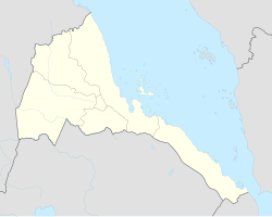
Massawa, also known as Mitsiwa, Miṣṣiwa), Batsiʿ, is a city on the Red Sea coast of Eritrea located at the northern end of the Gulf of Zula beside the Dahlak Archipelago. An important port for many centuries, it was ruled by a succession of polities, including the Axumite Empire, Medri Bahri Kingdom, the Umayyad Caliphate, various Beja sultanates, the Ottoman Empire, Egypt, Italy, Britain, and Ethiopia, until Eritrea's independence in 1991. Massawa was the capital of the Italian Colony of Eritrea until this was moved to Asmara in 1897.
Massawa was originally a small seaside village, lying in lands coextensive with the Kingdom of Axum in antiquity and overshadowed by the nearby port of Adulis about 50 kilometres (31 mi) to the south.
Following the fall of Axum in the 8th century, the area around Massawa and the town itself became occupied by the Umayyad Caliphate from AD 702 to 750. The Beja people would also come to rule within Massawa during the Beja Kingdom of Eritrea from AD 740 to the 14th century. Massawa was sited between the sultanates of Qata, Baqulin, and Dahlak. Midri-Bahri, an Eritrean kingdom (14th–19th centuries), gained leverage at various times and ruled over Massawa. The port city would also come under the supreme control of the Balaw people (people of Arab descent), during the Balaw Kingdom of Eritrea (12th–15th centuries). At this time, the Sheikh Hanafi Mosque, Eritrea's oldest mosque, was built on Massawa Island, along with several other works of early Islamic architecture both in and around Massawa (including the Dahlak Archipelago and the Zula peninsula).
...
Wikipedia

