Lycoming County
| Lycoming County, Pennsylvania | |
|---|---|

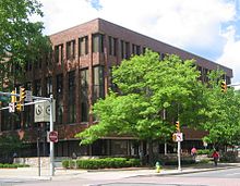
The Lycoming County courthouse in Williamsport
|
|
 Location in the U.S. state of Pennsylvania |
|
 Pennsylvania's location in the U.S. |
|
| Founded | April 13, 1795 |
| Named for | Lycoming Creek |
| Seat | Williamsport |
| Largest city | Williamsport |
| Area | |
| • Total | 1,244 sq mi (3,222 km2) |
| • Land | 1,229 sq mi (3,183 km2) |
| • Water | 15 sq mi (39 km2), 1.2% |
| Population (est.) | |
| • (2015) | 116,048 |
| • Density | 95/sq mi (37/km²) |
| Congressional district | 10th |
| Time zone | Eastern: UTC-5/-4 |
| Website | www |
Lycoming County is a county located in the Commonwealth of Pennsylvania. As of the 2010 census, the population was 116,111. Its county seat is Williamsport.
Lycoming County comprises the Williamsport, PA Metropolitan Statistical Area.
Located about 130 miles (209 km) northwest of Philadelphia and 165 miles (266 km) east-northeast of Pittsburgh, Lycoming County is the largest county in Pennsylvania in area.
Lycoming County was formed from Northumberland County on April 13, 1795. The county was larger than it is today. It took up most of the land that is now north central Pennsylvania. The following counties have been formed from land that was once part of Lycoming County: Armstrong, Bradford, Centre, Clearfield, Clinton, Indiana, Jefferson, McKean, Potter, Sullivan, Tioga, Venango, Warren, Forest, Elk and Cameron. Lycoming County was originally named Jefferson County in honor of Thomas Jefferson. This name proved to be unsatisfactory. The name change went through several steps. First a change to Lycoming County was rejected, next the name Susquehanna County was struck down as was Muncy County, before the legislature revisited and settled on Lycoming County for Lycoming Creek, the stream that was the center of the pre-Revolutionary border dispute.
...
Wikipedia
