Luni, Italy
| Luni | |
|---|---|
| Frazione | |

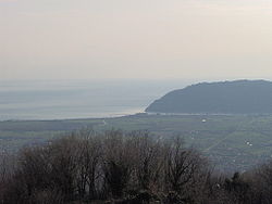
The plain of Luni and the village
|
|
| Coordinates: 44°04′00″N 10°02′00″E / 44.06667°N 10.03333°ECoordinates: 44°04′00″N 10°02′00″E / 44.06667°N 10.03333°E | |
| Country |
|
| Region |
|
| Province | La Spezia (SP) |
| Comune | Ortonovo |
| Elevation | 20 m (70 ft) |
| Population (2001) | |
| • Total | 1,000 |
| Demonym(s) | Lunensi |
| Time zone | CET (UTC+1) |
| • Summer (DST) | CEST (UTC+2) |
| Postal code | 19034 |
| Dialing code | (+39) 0187 |
Luni is a small town under the comune (municipality) of Ortonovo, province of La Spezia, in the easternmost end of the Liguria region of northern Italy. It gives its name to Lunigiana, a region spanning eastern Liguria and northern Tuscany (province of Massa-Carrara). Points of interest include remains of the elliptical Roman amphitheatre (1st century AD) and the Archaeological Museum.
Located in a plain near the Tyrrhenian Sea and close to the borders with Tuscany, Luni is crossed by the river Magra and lies between Sarzana (7 km in north) and Carrara (5 km in south). It is 4 km far from Ortonovo, 15 from Massa and 30 from La Spezia. The village is served by the National Highway 1 "Aurelia", crossed at Luni Mare by the A12 motorway and counts a railway station on the Pisa-Genoa line.
Founded by the Romans in 177 BC with the name Luna, at the mouth of the Magra, it was a military stronghold for the campaigns against the Ligures: there is an inscription in the Archaeological Museum from the base of a triumphal column erected in the second consulate of C. Claudius Marcellus to commemorate the repression of the last rebellion of the Ligures. In 109 BC it was connected to Rome by the Via Aemilia Scauri, rebuilt in the 2nd century AD as the Via Aurelia. It flourished when exploitation of white marble quarries in the nearby Alpi Apuane began in the 1st century BC and soon owned by the imperial family. Pliny the Elder considered the big wheels of cheese from Luna the best in Etruria.
...
Wikipedia
