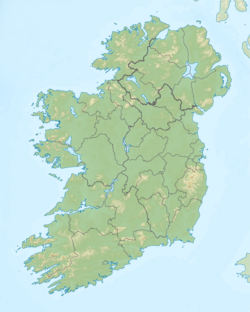
Lough Scur
| Lough Scur Loch an Scoir |
|
|---|---|
| Location | County Leitrim |
| Coordinates | 54°1′31″N 7°57′21″W / 54.02528°N 7.95583°WCoordinates: 54°1′31″N 7°57′21″W / 54.02528°N 7.95583°W |
| Lake type | Freshwater |
| Primary inflows | Aghacashlaun River, Shannon–Erne Waterway |
| Primary outflows | Shannon–Erne Waterway |
| Catchment area | 62.87 km2 (24.3 sq mi) |
| Basin countries | Ireland |
| Surface area | 1.14 km2 (0.44 sq mi) |
| Max. depth | 5 m (16 ft) |
| Surface elevation | 62 m (203 ft) |
| Islands | 2 |
| References | |
Lough Scur (Irish: Loch an Scoir, meaning "lake of the scur, or horse-stud") is a freshwater lake in south County Leitrim, northwest Ireland. It is part of the Shannon–Erne Waterway. There has been Human settlements here since the New Stone Age. Modern features include quays and moorings. Protected features are Castle John, three Crannogs, and the causeway into Rusheen Island, though "Jail Island" is not protected. The ecology of Lough Scur, and indeed all county Leitrim lakes, is threatened by pollution and invasive species such as curly waterweed, zebra mussel, and freshwater clam.
Fanciful folklore of the 19th century claimed Lough Scur was named from Oscar son of Oisín, and his grave lay at Aghascur, "the field of the Scur". However, it is pointed out the word "Scur" (Irish: Scor, genitive scuir) has various meanings, and the lake probably translates to "lake of the horse-stud" though O’Donovan alternatively gives the meaning "lake of the camp".
Lough Scur is about 1 kilometre (0.6 mi) northwest of Keshcarrigan. It covers an area of 1.14 square kilometres (0.4 sq mi). Lough Scur is deep with generally a soft mud or compact peat bottom, the shallowest portion is the northern reach, between Driny and Drumcong, probably due the a large quantity of detritus carried into it by a mountain stream at Annadale. Beyond the roscarbon shoal there is an isulated rock almost level with the summer water surface, nearly circular, measuring c. 10 – c. 15ft across. Lough Marrave might be considered a continuation of Lough Scur, as they share the same level and connected by a half-mile channel.Keshcarrigan lough is connected to Lough scur by a small stream about 250 metres (820.2 ft) in length. Carrickaport Lough drains into Lough Scur by a 450 metres (1,476.4 ft) stream running through Drumcong townland.Drumaleague Lough, lying 1 kilometre (0.6 mi) to the south west, is connected via the Shannon–Erne Waterway. Sub-glacial Rogen moraine landforms are evident in the valley between Slieve Anierin and Lough Scur, caused by ice age glaciers moving northeast to southwest over millions of years, the Morainic drift heaping up thousands of drumlins in the surrounding lowlands.
...
Wikipedia

