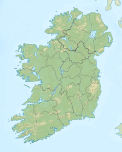
Drumaleague Lough
| Drumaleague Lough Droim Dhá Liag Loch |
|
|---|---|
| Coordinates | 54°0′59″N 7°59′7″W / 54.01639°N 7.98528°WCoordinates: 54°0′59″N 7°59′7″W / 54.01639°N 7.98528°W |
| Lake type | Freshwater |
| Primary inflows | Shannon–Erne Waterway |
| Primary outflows | Shannon–Erne Waterway |
| Basin countries | Ireland |
| Surface area | 0.05 km2 (0.019 sq mi) est. |
| Max. depth | 6 m (20 ft) est. |
| References | |
Drumaleague Lough (Irish: Droim Dhá Liag Loch, meaning "Lake of the ridge of the two stones") is a very small freshwater in northwest Ireland. The ecology of Drumaleague Lough, and other Leitrim waterways, remain threatened by zebra mussel and other invasive species.
The origin of the lake name is unknown, but (Irish: Droim Dhá Liag Loch) means the "Lake of the Ridge of two Stones, or Pillar-Stones".
Drumaleague Lough lies 1 kilometre (0.6 mi) south of both Drumcong village and Carrickaport Lough, and 1 kilometre (0.6 mi) southwest of Lough Scur. This eclipitical shaped lake is very small, covering a surface-area of about 0.05 square kilometres (0.0 sq mi), measuring 300 metres (984.3 ft) in length from west to east, and 170 metres (557.7 ft) north to south, with depths of up to 6 metres (19.7 ft) and a very soft mud bottom. Drumaleague Lough is connected to Lough Conway to the west, and Lough Scur to the east by the Shannon–Erne Waterway.
The presence, and type, of fish found in Drumaleague Lough is not recorded.
The primary human settlements near Drumaleague Lough is Drumcong village. Drumaleague Lough is bounded by the townlands of Letterfine to the north and east, Drumaleague to the west, and Seltan (McDonald) to the south and east.
Two ancient crannogs existed at Drumaleague Lough during the Middle Ages at least. The crannogs were discovered during the 19th century, c. 1843 – c. 1852.
...
Wikipedia

