Lopnur
| Lop Nur | |||||||||||

Satellite picture of the Basin of the former sea of Lop Nur, the concentric shorelines of the vanished lake are visible.
|
|||||||||||
|
|
|||||||||||
| Chinese name | |||||||||||
|---|---|---|---|---|---|---|---|---|---|---|---|
| Traditional Chinese | 羅布泊 | ||||||||||
| Simplified Chinese | 罗布泊 | ||||||||||
|
|||||||||||
| Alternative Chinese name | |||||||||||
| Traditional Chinese | 羅布淖爾 | ||||||||||
| Simplified Chinese | 罗布淖尔 | ||||||||||
|
|||||||||||
| Mongolian name | |||||||||||
| Mongolian | Лоп Нуур | ||||||||||
| Uyghur name | |||||||||||
| Uyghur |
لوپنۇر
|
||||||||||
|
|||||||||||
| Transcriptions | |
|---|---|
| Standard Mandarin | |
| Hanyu Pinyin | Luóbù Pō |
| Wade–Giles | Lo2-pu4 P'o1 |
| IPA | [lwǒpû pʰwó] |
| Transcriptions | |
|---|---|
| Standard Mandarin | |
| Hanyu Pinyin | Luóbù Nào'ěr |
| Wade–Giles | Lo2-pu4 Nao4-'erh3 |
| IPA | [lwǒpû nâwàɚ̯] |
| Transcriptions | |
|---|---|
| Latin Yëziqi | Lopnur |
| Yengi Yeziⱪ | Lopnur |
| Siril Yëziqi | Лопнур |
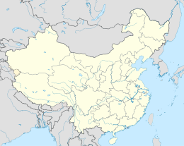
Lop Nur or Lop Nor (from a Mongolian name meaning "Lop Lake") is a former salt lake in China, now largely dried-up, located between the Taklamakan and Kumtag deserts in the southeastern portion of Xinjiang Uygur Autonomous Region in the People's Republic of China. Administratively, the lake is in Lop Nur township ( pinyin: Luóbùpō zhèn, also known as Luozhong 罗中, pinyin: Luō zhōng) of Ruoqiang County, which in its turn is part of the Bayingolin Mongol Autonomous Prefecture.
The lake system into which the Tarim River and Shule River empty is the last remnant of the historical post-glacial Tarim Lake, which once covered more than 10,000 km2 (3,900 sq mi) in the Tarim Basin. Lop Nur is hydrologically endorheic— it is landbound and there is no outlet. The lake measured 3,100 km2 (1,200 sq mi) in 1928, but has dried up due to construction of dams which blocked the flow of water feeding into the lake system, and only small seasonal lakes and marshes may form. The dried-up Lop Nur Basin is covered with a salt crust ranging from 30 cm to 1 m in thickness.
Lop Nur has been used as a nuclear testing site, and since the discovery of potash at the site in the mid-1990s it is also the location of a large-scale mining operation.
From around 1800 BC, until the 9th century the lake supported a thriving culture. Archaeologists have discovered the buried remains of settlements, as well as several of the Tarim mummies, along its ancient shoreline. Former water resources of the Tarim River and Lop Nur nurtured the kingdom of Loulan since the second century BC, an ancient civilization along the Silk Road, which skirted the lake-filled basin. Loulan became a client-state of the Chinese empire in 55 BC, renamed Shanshan. Marco Polo in his travels passed through the Lop Desert, and the famous explorers Ferdinand von Richthofen, Nikolai Przhevalsky, Sven Hedin and Aurel Stein visited and studied the area. It is also likely that Swedish soldier Johan Gustaf Renat had visited the area when he was helping the Zunghars to produce maps over the area in the eighteenth century.
...
Wikipedia

