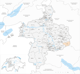
Linden, Switzerland
| Linden | ||
|---|---|---|
|
||
| Coordinates: 46°51′N 7°41′E / 46.850°N 7.683°ECoordinates: 46°51′N 7°41′E / 46.850°N 7.683°E | ||
| Country | Switzerland | |
| Canton | Bern | |
| District | Bern-Mittelland | |
| Area | ||
| • Total | 13.23 km2 (5.11 sq mi) | |
| Elevation | 916 m (3,005 ft) | |
| Population (Dec 2015) | ||
| • Total | 1,277 | |
| • Density | 97/km2 (250/sq mi) | |
| Postal code | 3673 | |
| SFOS number | 0614 | |
| Surrounded by | Aeschlen, Bowil, Buchholterberg, Freimettigen, Niederhünigen, Oberdiessbach, Oberhünigen, Röthenbach im Emmental | |
| Website |
www SFSO statistics |
|
Linden is a municipality in the Bern-Mittelland administrative district in the canton of Bern in Switzerland.
The municipality was formed in 1945 when the former municipalities of Ausserbirrmoos, Innerbirrmoos, and Otterbach merged.
Ausserbirrmoos was the largest in land area of the three communities that formed Linden. It was first mentioned in 1298 as Birmos. Throughout the Middle Ages it was part of the Herrschaft of Diessbach. Originally it formed a single community with Innerbirrmoos, but in 1633 the two communities separated to form independent municipalities. It absorbed the land and population of the communities of Schöntal (BE) and Barschwand when they dissolved in 1887. In 1941, before the merger, it had a population of 466.
It was mentioned, along with Ausserbirrmoos, in 1298. Around 1399 it became part of the Bernese district of Röthenbach. Then, in 1529 it became part of the Landvogtei of Signau. It separated from Ausserbirrmoos in 1633. For much of its history, the established farmers and the landless sharecroppers fought each other over usage of the commons. Finally, over a decade starting 1778, the city of Bern intervened and ended the conflict. In 1941, it had a population of 558. Today, the village is still mostly agricultural.
Otterbach is first mentioned in 1236 as Ottirbach. Like Innerbirrmoos, around 1399 it became part of the Bernese district of Röthenbach and in 1529 the Landvogtei of Signau. It was the smallest and poorest of the three municipalities that joined to form Linden. In 1941 it had a population of 310.
The hamlet of Linden was first mentioned in 1354. While it was geographically in the center of the three municipalities, it was never an independent municipality itself. All three municipalities, Ausserbirrmoos, Innerbirrmoos, and Otterbach, were part of the parish of Oberdiessbach until 1860, when they broke away to form the parish of Kurzenberg. After the creation of the independent municipality of Linden in 1945, it became the parish of Linden. The parish church was built in the hamlet of Linden in 1848. Since it was in the center of the communities, the local school was also built there. Beginning in the 1970s, a training base for the Swiss Army opened in the community. Today the municipality is still rural and agricultural in character, though about two-thirds of the working population commute to jobs outside the municipality.
...
Wikipedia


