Niederhünigen
| Niederhünigen | ||
|---|---|---|
|
||
| Coordinates: 46°53′N 7°38′E / 46.883°N 7.633°ECoordinates: 46°53′N 7°38′E / 46.883°N 7.633°E | ||
| Country | Switzerland | |
| Canton | Bern | |
| District | Bern-Mittelland | |
| Area | ||
| • Total | 5.41 km2 (2.09 sq mi) | |
| Elevation | 685 m (2,247 ft) | |
| Population (Dec 2015) | ||
| • Total | 606 | |
| • Density | 110/km2 (290/sq mi) | |
| Postal code | 3504 | |
| SFOS number | 0617 | |
| Surrounded by | Freimettigen, Konolfingen, Linden, Mirchel, Oberhünigen | |
| Website |
www SFSO statistics |
|
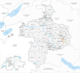
Niederhünigen is a municipality in the Bern-Mittelland administrative district in the canton of Bern in Switzerland.
Niederhünigen is first mentioned in 1148 as Huningen inferior.
During the Middle Ages, Niederhünigen village was part of the Herrschaft of Hünigen. It was originally ruled by the Ministerialis (unfree knights in the service of a feudal overlord) family of Senn von Münsingen. By 1380 or 1393 the village was owned by the Bokess family from Thun. After they sold it in 1421, it passed through a number of owners. In the 16th century the medieval Hünigen water castle outside the village was destroyed in a fire. In 1554, Niklaus von Scharnachtal had a new Hünigen Castle built near the mill at Stalden. In 1588, the Bernese patrician von May family acquired the village and castle, which they occupied until 1922. The von May family also ruled the village until the 1798 French invasion and the creation of the Helvetic Republic. In 1933, the village of Stalden, with the castle, merged with Gysenstein to form Konolfingen. Niederhünigen has remained generally rural and agricultural into the 21st century.
Niederhünigen was part of the parish of Münsingen until 1911 when the parish of Stalden was formed. In the following year, the parish was renamed to Konolfingen and Niederhünigen remained a part of the new parish.
Niederhünigen has an area of 5.41 km2 (2.09 sq mi). Of this area, 2.77 km2 (1.07 sq mi) or 51.2% is used for agricultural purposes, while 2.28 km2 (0.88 sq mi) or 42.1% is forested. Of the rest of the land, 0.33 km2 (0.13 sq mi) or 6.1% is settled (buildings or roads).
...
Wikipedia


