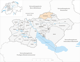
Buchholterberg
| Buchholterberg | ||
|---|---|---|
 |
||
|
||
| Coordinates: 46°49′N 7°41′E / 46.817°N 7.683°ECoordinates: 46°49′N 7°41′E / 46.817°N 7.683°E | ||
| Country | Switzerland | |
| Canton | Bern | |
| District | Thun | |
| Government | ||
| • Mayor | Beat Haldimann | |
| Area | ||
| • Total | 15.32 km2 (5.92 sq mi) | |
| Elevation | 1,006 m (3,301 ft) | |
| Population (Dec 2015) | ||
| • Total | 1,546 | |
| • Density | 100/km2 (260/sq mi) | |
| Postal code | 3615 | |
| SFOS number | 0923 | |
| Surrounded by | Aeschlen, Bleiken bei Oberdiessbach, Fahrni, Linden, Röthenbach im Emmental, Unterlangenegg, Wachseldorn | |
| Website |
www SFSO statistics |
|
Buchholterberg is a municipality in the administrative district of Thun in the canton of Bern in Switzerland.
Buchholterberg is first mentioned in 1268 as Bucholtron.
The municipality was gradually settled as farmers moved out from other villages into the villages that would make up Buchholterberg. By 1257 Graf Ulrich von Buchegg was mentioned as owning some property in the villages. Other Bernese patricians also held lands in the area. In 1399, the entire area was acquired by the city of Bern and added to the Röthenbach District. It was later assigned to the Landvogtei of Signau and then the Konolfingen District before joining the Thun District in 1864. Originally Buchholterberg, Wachseldorn, Süderen and Bleiken were all combined into the Buchholterberg-third of the parish of Oberdiessbach. In 1805 parts of Buchholterberg and Wachseldorn-Gützenschwendi merged to form a political municipality and a parish. However, in 1823, they separated into two political municipalities (Buchholterberg and Wachseldorn), but remained a combined parish under Oberdiessbach. In 1860 the independent Buchholterberg parish was created, which included all the municipality along with Wachseldorn.
Traditionally the local residents practiced seasonal alpine herding where they raised cattle in high meadows during the summer and over wintered on the valley floor. Only a limited number of crops were grown on the valley floor. In 1857-68 a road was built linking the municipality with Steffisburg and the rest of the Aare river valley. Other roads eventually connected it to Oberdiessbach and the upper Emmental and a PostBus bus route now connects the municipality to Thun. However, the large, sparsely settled municipality remains very rural and agrarian. In 1990 over half of the residents commuted to jobs in nearby cities and many of the remaining workers were employed in dairy farming.
...
Wikipedia


