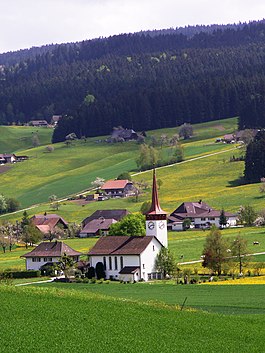
Bowil
| Bowil | ||
|---|---|---|
 |
||
|
||
| Coordinates: 46°54′N 7°42′E / 46.900°N 7.700°ECoordinates: 46°54′N 7°42′E / 46.900°N 7.700°E | ||
| Country | Switzerland | |
| Canton | Bern | |
| District | Bern-Mittelland | |
| Area | ||
| • Total | 14.68 km2 (5.67 sq mi) | |
| Elevation | 733 m (2,405 ft) | |
| Population (Dec 2015) | ||
| • Total | 1,370 | |
| • Density | 93/km2 (240/sq mi) | |
| Postal code | 3533 | |
| SFOS number | 0605 | |
| Surrounded by | Linden, Oberhünigen, Oberthal, Röthenbach im Emmental, Signau, Zäziwil | |
| Website |
www SFSO statistics |
|
Bowil is a municipality in the Bern-Mittelland administrative district in the canton of Bern in Switzerland.
Bowil is first mentioned in 1299 as Bonwile.
The village was once part of the Herrschaft of Signau and the Freiherren of Signau built their castles, Alt-Signau and Neu-Signau, between Bowil and Signau villages. Today, the municipal border has been redrawn and the ruins of both castles are in Bowil. During the Middle Ages, Bowil was part of the lands of the Freiherr of Signau, but other distant landowners and local farmers owned rights or property in the village. In 1528, Bern adopted the Protestant Reformation and Bowil quickly followed. However, in the following years, it became a haven for Anabaptists. In 1720, to try to convert the Anabaptists to the Swiss Reformed faith, Bern established a filial church in the village. In 1930 that church became a parish church over the parish of Bowil-Oberthal.
Traditionally the village economy relied on subsistence agriculture. However, in the late 18th century local farmers began to raise grass which they could harvest as hay for cattle. By the 19th century, dairy farming had replaced traditional agriculture. In 1901 a railway station connected the village to the rest of the country. The easy transportation connection encouraged small factories to move into Bowil. However, in 1990 one-third of the jobs in the village were still in agriculture.
Bowil has an area of 14.68 km2 (5.67 sq mi). Of this area, 8.08 km2 (3.12 sq mi) or 55.0% is used for agricultural purposes, while 5.81 km2 (2.24 sq mi) or 39.6% is forested. Of the rest of the land, 0.75 km2 (0.29 sq mi) or 5.1% is settled (buildings or roads), 0.06 km2 (15 acres) or 0.4% is either rivers or lakes.
...
Wikipedia


