Kuzguncuk
| Kuzguncuk | |
|---|---|
| Neighborhood | |
| Coordinates: 41°02′12″N 29°01′47″E / 41.03667°N 29.02972°ECoordinates: 41°02′12″N 29°01′47″E / 41.03667°N 29.02972°E | |
| Country |
|
| Region | Marmara |
| Province | Istanbul |
| District | Üsküdar |
| Time zone | EET (UTC+2) |
| • Summer (DST) | EEST (UTC+3) |
| Postal code | 34674 |
| Area code | 0-216 |
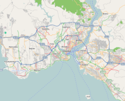
Kuzguncuk is a neighborhood in the Üsküdar district on the Asian side of the Bosphorus in Istanbul, Turkey. The neighborhood is centered on a valley opening to the Bosphorus and is somewhat isolated from the main part of the city, being surrounded by nature preserves, cemeteries, and a military installation. It is a quiet neighborhood with streets lined with antique wooden houses.
Kuzguncuk is bordered on the north by Beylerbeyi, on the east by Burhaniye, on the south by İcadiye and Sultantepe, and on the west by the Bosphorus. On the other side of the Bosphorus is Beşiktaş. The Otoyol 1 ![]() highway separates the neighborhood from Burhaniye.
highway separates the neighborhood from Burhaniye.
The word kuzguncuk means "little raven" or "barred window of a prison door" in Turkish. The name is said to have come from a holy person named Kuzgun Baba, who lived in the area during the time of Sultan Mehmet II or from the corruption of a previous name, Kozinitza.
During Byzantine times, this area may have been called Khrysokeramos (Hrisokeramos), meaning "golden tile," because of a church here with a gilded roof. Around 553, Narses had a church built here dedicated to the Virgin Mary.
Jews, who were expelled from Spain and Portugal, began settling in the Ottoman Empire in the late 15th century. As voluntary immigrants, they had more freedom concerning their place of residence, and many left the traditional Jewish quarters of Istanbul such as Balat for villages along the Bosphorus such as Kuzguncuk. The earliest evidence of Jewish presence in the neighborhood is a tombstone dated 1562.
...
Wikipedia

