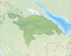
Kreuzlingen, Switzerland
| Kreuzlingen | ||
|---|---|---|

Kreuzlingen in early-October 2009
|
||
|
||
| Coordinates: 47°38′N 9°10′E / 47.633°N 9.167°ECoordinates: 47°38′N 9°10′E / 47.633°N 9.167°E | ||
| Country | Switzerland | |
| Canton | Thurgau | |
| District | Kreuzlingen | |
| Government | ||
| • Executive |
Stadtrat with 5 members |
|
| • Mayor |
Stadtammann (list) Andreas Netzle (as of March 2014) |
|
| • Parliament |
Gemeinderat with 40 members |
|
| Area | ||
| • Total | 11.49 km2 (4.44 sq mi) | |
| Elevation | 397 m (1,302 ft) | |
| Population (Dec 2015) | ||
| • Total | 21,542 | |
| • Density | 1,900/km2 (4,900/sq mi) | |
| Postal code | 8280 | |
| SFOS number | 4671 | |
| Localities | Emmishofen, Kurzrickenbach | |
| Surrounded by | Bottighofen, Constance (Konstanz) (DE-BW), Kemmental, Lengwil, Tägerwilen | |
| Twin towns | Wolfach (Germany), Cisternino (Italy) | |
| Website |
www SFSO statistics |
|
Kreuzlingen is a municipality in the district of Kreuzlingen in the canton of Thurgau in north-eastern Switzerland. It is the seat of the district and is the second largest city of the canton, after Frauenfeld, with a population of about 20,800. Together with the adjoining city of Konstanz just across the border in Germany, Kreuzlingen is part of the largest conurbation on Lake Constance with a population of almost 120,000.
In 1874, the municipality of Egelshofen was renamed Kreuzlingen. It reached its present size with the incorporation of Kurzrickenbach in 1927 and Emmishofen in 1928.
The name of the municipality stems from the Augustinian monastery Crucelin, later Kreuzlingen Abbey. It was founded in 1125 by the Bishop of Constance Ulrich I. In the Swabian War and the 30 Years' War after the siege of Constance by Swedish troops, the Augustinian monastery was burned down by the people of Constance, who blamed the monks for having supported the enemy. In 1650, the monastery was rebuilt in its present location. With secularization in 1848, the buildings became a teachers' school. The chapel became a Catholic church
The area was already settled during the Bronze Age. Celtic and Roman coins and artifacts testify of continued settlement. Kurzrickenbach is first mentioned as Rihinbah in 830, Egelshofen as Eigolteshoven in 1125, and Emmishofen as Eminshoven in 1159. The territory of the municipality, except for the Augustinian monastery, belonged to the Bishop of Constance. When the Eidgenossen conquered Thurgau in 1460 and further with the Reformation, the ties to the neighboring city loosened.
...
Wikipedia


