Kachkanar
| Kachkanar (English) Качканар (Russian) |
|
|---|---|
| - Town - | |
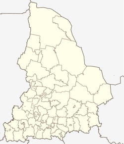
 Location of Sverdlovsk Oblast in Russia |
|
|
|
|
|
|
|
|
|
|
| Administrative status (as of April 2014) | |
| Country | Russia |
| Federal subject | Sverdlovsk Oblast |
| Administratively subordinated to | Town of Kachkanar |
| Administrative center of | Town of Kachkanar |
| Municipal status (as of April 2014) | |
| Urban okrug | Kachkanarsky Urban Okrug |
| Administrative center of | Kachkanarsky Urban Okrug |
| Statistics | |
| Population (2010 Census) | 41,426 inhabitants |
| Time zone | YEKT (UTC+05:00) |
| Founded | 1957 |
| Town status since | 1968 |
| Postal code(s) | 624350, 624351, 624354, 624356, 624357 |
|
|
|
| on | |
Kachkanar (Russian: Качкана́р) is a town in Sverdlovsk Oblast, Russia, located between the Isa and Vyya Rivers in the Tura River's basin, 205 kilometers (127 mi) north of Yekaterinburg, the administrative center of the oblast. Population: 41,426 (2010 Census);44,664 (2002 Census);48,251 (1989 Census).
It was founded in 1957 as an ore mining settlement and was granted urban-type settlement status in 1959. Town status was granted to it in 1968.
Within the framework of the administrative divisions, it is, together with two rural localities, incorporated as the Town of Kachkanar—an administrative unit with the status equal to that of the districts. As a municipal division, the Town of Kachkanar is incorporated as Kachkanarsky Urban Okrug.
The town is connected with a 44-kilometer (27 mi) long branch line to the Perm–Nizhny Tagil–Yekaterinburg main railway line. There is an open-pit mine to the north.
...
Wikipedia


