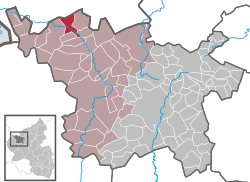
Jünkerath
| Jünkerath | ||
|---|---|---|
|
||
| Coordinates: 50°20′29″N 6°35′09″E / 50.34139°N 6.58583°ECoordinates: 50°20′29″N 6°35′09″E / 50.34139°N 6.58583°E | ||
| Country | Germany | |
| State | Rhineland-Palatinate | |
| District | Vulkaneifel | |
| Municipal assoc. | Obere Kyll | |
| Government | ||
| • Mayor | Rainer Helfen | |
| Area | ||
| • Total | 10.10 km2 (3.90 sq mi) | |
| Elevation | 430 m (1,410 ft) | |
| Population (2015-12-31) | ||
| • Total | 1,771 | |
| • Density | 180/km2 (450/sq mi) | |
| Time zone | CET/CEST (UTC+1/+2) | |
| Postal codes | 54584 | |
| Dialling codes | 06597 | |
| Vehicle registration | DAU | |
| Website | www.juenkerath.de | |
Jünkerath is an Ortsgemeinde – a municipality belonging to a Verbandsgemeinde, a kind of collective municipality – in the Vulkaneifel district in Rhineland-Palatinate, Germany. It belongs to the Verbandsgemeinde of Obere Kyll, and is home to its seat.
Jünkerath, along with its outlying centre (Ortsteil) of Glaadt, lies in the Kyll valley in the Eifel. Geologically, Jünkerath is part of the Kalkeifel (“Limestone Eifel”).
Jünkerath is among the Eifel’s oldest places. The name is derived from Icorigium, a station on the Trier-Cologne Roman road, which was marked as early as the 4th century on the Tabula Peutingeriana.
As a result of the Treaty of Lunéville, Jünkerath passed along with the rest of the lands on the Rhine’s left bank to France in 1801, and then in 1815 came the cession to Prussia. Count Sternberg-Manderscheid acquired in the 1803 Reichsdeputationshauptschluss as the landholder, among other things, the holdings formerly belonging to the monasteries at Weissenau and Schussenried in Upper Swabia to offset his loss of Blankenheim, Jünkerath, Gerolstein and Dollendorf.
...
Wikipedia


