Iquitos várzea
| Iquitos várzea | |
|---|---|

|
|
| Ecology | |
| Realm | Neotropical |
| Biome | Tropical and subtropical moist broadleaf forests |
| Geography | |
| Area | 114,995 km2 |
| Countries | Brazil, Bolivia, Peru |
| Coordinates | 5°10′12″S 74°45′18″W / 5.170°S 74.755°WCoordinates: 5°10′12″S 74°45′18″W / 5.170°S 74.755°W |
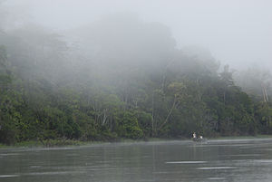
The Iquitos várzea (NT0128) is an ecoregion of flooded forest along rivers in Brazil, Peru and Bolivia in the west of the Amazon biome. The forest is seasonally flooded up to 7 metres (23 ft) by whitewater rivers carrying nutrient-rich sediment from the Andes. The meandering rivers often shift course, creating a complex landscape of oxbow lakes, marshes, levees and bars, with grasslands, shrubs and forests in different stages of succession. During the extended flood periods fish enter the forest in search of fruit. The várzea is accessible by the navigable rivers that run through it, and has suffered from extensive deforestation to extract timber and create pasture for livestock.
The Iquitos várzea has an area of 11,499,547 hectares (28,416,000 acres) in northwest Brazil, northeast Peru and northern Bolivia. The várzea, or flooded forest, is found along seasonally flooded basins of tributaries of the upper Amazon River, and of the Amazon itself. To the west the Iquitos várzea extends to the highest places where várzea is found in the Amazon region. The eastern boundary is defined by the Iquitos arch, an ancient crystalline arch that crosses the Amazon basin. Beyond this arch the Iquitos várzea ecoregion merges into the Purus várzea ecoregion.
The Iquitos várzea is found along river sections within several other Amazon ecoregions. The southern sections of the Iquitos várzea are in the Southwest Amazon moist forests. The várzea forms the eastern boundary of the Ucayali moist forests and the Napo moist forests, and penetrates along river courses into both these ecoregions. It forms the southwest boundary of the Solimões-Japurá moist forests.
The whitewater rivers carry sediments washed down from the Andes, which are deposited to form extremely fertile soil. The ecoregion is named after the Peruvian town of Iquitos on the Amazon, which floods twice a year, with floods lasting for up to 10 months. At its peak the forest is flooded by 6 to 7 metres (20 to 23 ft) of water across a stretch along the river 19 kilometres (12 mi) wide. The soil is made of alluvial and fluvial sediments deposited in the present Holocene epoch. The rivers meander through their floodplains and sometimes change course, creating oxbow lakes, levees, swales, point bars and short-lived islands. The shifting landscape holds large swathes of primary succession forest.
...
Wikipedia
