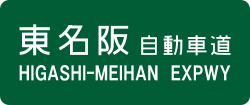
Higashimeihan Expressway
| Higashi-Meihan Expressway | |
|---|---|
| 東名阪自動車道 | |
| Route information | |
| Length: | 55.1 km (34.2 mi) |
| Existed: | 1970 – present |
| Major junctions | |
| From: |
Nagoya-nishi Junction in Nagoya |
| To: |
Ise-Seki Interchange in Tsu, Mie |
| Location | |
| Major cities: | Ama, Aisai, Yatomi, Kuwana, Yokkaichi, Suzuka, Kameyama |
| Highway system | |
|
National highways of Japan Expressways of Japan |
|
| Nagoya Daini Kanjo (Mei-Nikan) Expressway | |
|---|---|
| 名古屋第二環状自動車道 | |
| Route information | |
| Length: | 43.7 km (27.2 mi) |
| Existed: | 1988 – present |
| Major junctions | |
| From: |
Nagoya-minami Junction in Nagoya |
| To: |
Nagoya-nishi Junction in Nagoya |
| Location | |
| Major cities: | Kasugai, Kiyosu, Ama, Oharu |
| Highway system | |
|
National highways of Japan Expressways of Japan |
|
The Higashi-Meihan Expressway (東名阪自動車道 Higashimeihan Jidōshadō) is a four lane national expressway in the Tōkai region of Japan. It is owned and operated by Central Nippon Expressway Company.
Meihan is a kanji acronym of two characters. The first character represents Nagoya (名古屋) and the second character represents Osaka (大阪). Higashi (東) means east; together with the Meihan Highway and Nishi-Meihan Expressway, it forms a corridor linking the greater Nagoya and Osaka areas.
Officially, the route is designated as the Kinki Expressway Nagoya Osaka Route, however this designation does not appear on any signage. In some areas, signs on the route are written in Japanese as 東名阪道 or ひがし名阪道; this is to prevent confusion with the Tōmei Expressway which looks similar when written in Japanese.
...
Wikipedia


