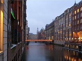
Hamburg-Neustadt
| Neustadt | |||
|---|---|---|---|
| Second-level subdivision of Hamburg German: Stadtteil |
|||

|
|||
|
|||
 Location of Neustadt within Hamburg-Mitte |
|||
| Coordinates: 53°33′7″N 9°59′8″E / 53.55194°N 9.98556°ECoordinates: 53°33′7″N 9°59′8″E / 53.55194°N 9.98556°E | |||
| Country | Germany | ||
| State | Hamburg | ||
| City | Hamburg | ||
| Borough (Bezirk) | Hamburg-Mitte | ||
| Area | |||
| • Total | 2.2 km2 (0.8 sq mi) | ||
| Elevation | 10 m (30 ft) | ||
| Population (31 December 2013) | |||
| • Total | 5,591 | ||
| • Density | 2,500/km2 (6,600/sq mi) | ||
| Time zone | CET (UTC+1) | ||
| Dialling code(s) | 040 | ||
| ISO 3166 code | DE-HH | ||
| Vehicle registration | HH | ||
| Website | www.hamburg.de | ||
Neustadt (German pronunciation: [nɔʏʃtat], literally: "New town") is one of the inner-city districts of the Free and Hanseatic City of Hamburg, Germany.
By 1529, Hamburg was firmly anchored in Lutheran Reformation and had successfully managed to divert its trade away from the Baltic to more dynamic markets along the Atlantic. Hamburg's economy boomed, between 1526 and 1551 the state budget tripled, and the Hanseatic city had become a major trade and capital market. Meanwhile, persecution of Protestants in the Low Countries, other parts of Germany, Portugal, Spain and various other parts of Europe caused an immense influx of religious refugees into Hamburg. Between 1500 and 1600, the population of Hamburg tripled to 40,000, surpassing Lübeck as largest German port city.
In advance of the Thirty Years' War (1618–1648), the Hamburg Senate commissioned Dutch military engineer Johan van Valckenburgh to strengthen the city's defenses. The new Hamburg Ramparts (Wallanlagen) were also meant to meet demand for additional space to be within the city. When completed in 1626, the ramparts enclosed all of Altstadt, plus an almost equally large area west of it: the so-called Neustadt.
Neustadt was laid out in a mostly rectangular street grid, though not much of that is recognizable today. Additionally, three principal streets connected the old town (Alstadt) east of the Alster River with the two new city-gates out west. Each of these three streets was given a market square at half distance: Gänsemarkt in the northern Neustadt, Schaarmarkt in the southern Neustadt, and Großneumarkt in the very center. The northern Neustadt around Gänsemarkt became a quarter of the wealthy and well-off citizens. Later this area also developed into Hamburg's opera district, the area around Jungfernstieg eventually developed into an elegant shopping district. In contrast, many parts of the southern Neustadt became shady quarters of the port's workers. Up until the late 19th and early 20th century, Neustadt was famous for its many "Gängeviertel": quarters with narrow alleys (Low German: Gänge). In 1893 Neustadt was ravaged by a Cholera epidemic. Due to continuing, unsustainable hygienic conditions, by the 1960s most of the Gängeviertel were demolished.
...
Wikipedia
