Great Kanawha River
| Kanawha River | |
| River | |
|
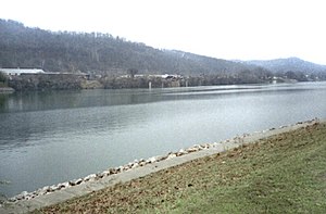
Kanawha River at St. Albans, West Virginia
|
|
| Country | United States |
|---|---|
| State | West Virginia |
| Counties | Fayette, Kanawha, Mason, Putnam |
| Tributaries | |
| - left | Coal River |
| - right | Elk River, Pocatalico River |
| Source | New River |
| - location | Ashe County, NC |
| - elevation | 2,546 ft (776 m) |
| - coordinates | 36°32′45″N 81°21′09″W / 36.54583°N 81.35250°W |
| Secondary source | Gauley River |
| - location | Three Forks of Gauley, Pocahontas County, WV |
| - elevation | 2,917 ft (889 m) |
| - coordinates | 38°24′33″N 80°14′17″W / 38.40917°N 80.23806°W |
| Source confluence | |
| - location | Gauley Bridge, WV |
| - elevation | 653 ft (199 m) |
| - coordinates | 38°09′42″N 81°11′47″W / 38.16167°N 81.19639°W |
| Mouth | Ohio River |
| - location | Point Pleasant, WV |
| - elevation | 538 ft (164 m) |
| - coordinates | 38°50′16″N 82°08′34″W / 38.83778°N 82.14278°WCoordinates: 38°50′16″N 82°08′34″W / 38.83778°N 82.14278°W |
| Length | 97 mi (156 km) |
| Basin | 12,236 sq mi (31,691 km2) |
| Discharge | for Charleston, 56.8 mi (91.4 km) from the mouth |
| - average | 15,240 cu ft/s (432 m3/s) |
| - max | 216,000 cu ft/s (6,116 m3/s) |
| - min | 1,100 cu ft/s (31 m3/s) |
|
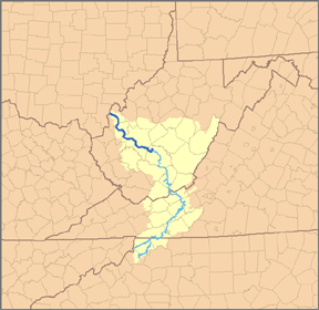
Map of the Kanawha River and its tributary the New River, with the Kanawha River highlighted in darker blue.
|
|
The Kanawha River (/kəˈnɔː/ kə-NAW or /kəˈnɔːə/ kə-NAW-ə) is a tributary of the Ohio River, approximately 97 mi (156 km) long, in the U.S. state of West Virginia. The largest inland waterway in West Virginia, it has formed a significant industrial region of the state since the middle of the 19th century.
It is formed at the town of Gauley Bridge in northwestern Fayette County, approximately 35 mi (56 km) SE of Charleston, by the confluence of the New and Gauley rivers. It flows generally northwest, in a winding course on the unglaciated Allegheny Plateau, through Fayette, Kanawha, Putnam, and Mason counties, past the cities of Charleston and St. Albans, and numerous smaller communities. It joins the Ohio at Point Pleasant.
...
Wikipedia


