Geography of Croatia
 |
|
| Continent | Europe |
|---|---|
| Region | Central and Southeast Europe |
| Coordinates | 45°8′30″N 16°13′45″E / 45.14167°N 16.22917°ECoordinates: 45°8′30″N 16°13′45″E / 45.14167°N 16.22917°E |
| Area | Ranked 127 |
| • Total | 56,594 km2 (21,851 sq mi) |
| • Land | 99% |
| • Water | 1% |
| Coastline | 5,835.3 km (3,625.9 mi) |
| Borders | 2,237 km (1,390 mi) |
| Highest point |
Dinara 1,831 m (6,007 ft) |
| Lowest point |
Adriatic Sea (sea level) |
| Longest river |
Sava 562 km (349 mi) |
| Largest lake |
Lake Vrana 30.7 km2 (11.9 sq mi) |
| Most populous cities of Croatia | ||||||||||
|---|---|---|---|---|---|---|---|---|---|---|
|
|
Rank | City | County | Urban population | City-governed population | |||||
| 1 | Zagreb | City of Zagreb | 688,163 | 790,017 | ||||||
| 2 | Split | Split-Dalmatia | 167,121 | 178,102 | ||||||
| 3 | Rijeka | Primorje-Gorski Kotar | 128,314 | 128,624 | ||||||
| 4 | Osijek | Osijek-Baranja | 83,104 | 108,048 | ||||||
| 5 | Zadar | Zadar | 71,471 | 75,082 | ||||||
| 6 | Pula | Istria | 57,460 | 57,460 | ||||||
| 7 | Slavonski Brod | Brod-Posavina | 53,531 | 59,143 | ||||||
| 8 | Karlovac | Karlovac | 46,833 | 55,705 | ||||||
| 9 | Varaždin | Varaždin | 38,839 | 46,946 | ||||||
| 10 | Šibenik | Šibenik-Knin | 34,302 | 46,332 | ||||||
| 11 | Sisak | Sisak-Moslavina | 33,332 | 47,768 | ||||||
| 12 | Vinkovci | Vukovar-Srijem | 32,032 | 35,312 | ||||||
| 13 | Velika Gorica | Zagreb | 31,553 | 63,517 | ||||||
| 14 | Dubrovnik | Dubrovnik-Neretva | 28,434 | 42,615 | ||||||
| 15 | Bjelovar | Bjelovar-Bilogora | 27,024 | 40,276 | ||||||
| 16 | Vukovar | Vukovar-Srijem | 26,486 | 27,683 | ||||||
| 17 | Koprivnica | Koprivnica-Križevci | 23,955 | 30,854 | ||||||
| 18 | Solin | Split-Dalmatia | 20,212 | 23,926 | ||||||
| 19 | Zaprešić | Zagreb | 19,644 | 25,226 | ||||||
| 20 | Požega | Požega-Slavonia | 19,506 | 26,248 | ||||||
| Source: 2011 Census | ||||||||||
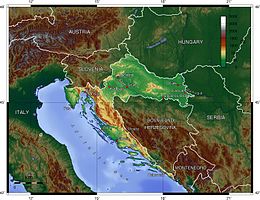
The geography of Croatia is defined by its location— it is described as a part of Central and Southeast Europe, a part of the Balkans and Mitteleuropa. Croatia's territory covers 56,594 km2 (21,851 sq mi), making it the 127th largest country in the world. Bordered by Bosnia and Herzegovina and Serbia in the east, Slovenia in the west, Hungary in the north and Montenegro and the Adriatic Sea in the south, it lies mostly between latitudes 42° and 47° N and longitudes 13° and 20° E. Croatia's territorial waters encompass 18,981 square kilometres (7,329 sq mi) in a 12 nautical miles (22 km; 14 mi) wide zone, and its internal waters located within the baseline cover an additional 12,498 square kilometres (4,826 sq mi).
The Pannonian Basin and the Dinaric Alps, along with the Adriatic Basin, represent major geomorphological parts of Croatia. Lowlands make up the bulk of Croatia, with elevations of less than 200 metres (660 ft) above sea level recorded in 53.42% of the country. Most of the lowlands are found in the northern regions, especially in Slavonia, itself a part of the Pannonian Basin plain. The plains are interspersed with horst and graben structures, believed to have broken the Pliocene Pannonian Sea's surface as islands. The greatest concentration of ground at relatively high elevations is found in the Lika and Gorski Kotar areas in the Dinaric Alps, but high areas are found in all regions of Croatia to some extent. The Dinaric Alps contain the highest mountain in Croatia—1,831-metre (6,007 ft) Dinara—as well as all other mountains in Croatia higher than 1,500 metres (4,900 ft). Croatia's Adriatic Sea mainland coast is 1,777.3 kilometres (1,104.4 mi) long, while its 1,246 islands and islets encompass a further 4,058 kilometres (2,522 mi) of coastline—the most indented coastline in the Mediterranean. Karst topography makes up about half of Croatia and is especially prominent in the Dinaric Alps, as well as throughout the coastal areas and the islands.
...
Wikipedia


