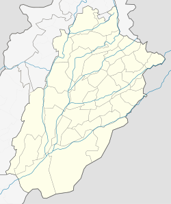
Fort Abbas Tehsil
|
Fort Abbas فورٹ عبّاس Pholra Fort |
|
|---|---|
| Tehsil | |
| Location of Fort Abbas | |
| Coordinates: 29°11′37″N 72°51′16″E / 29.19361°N 72.85444°ECoordinates: 29°11′37″N 72°51′16″E / 29.19361°N 72.85444°E | |
| Country | Pakistan |
| Region | Punjab |
| District | Bahawalnagar District |
| Number of towns | 1 |
| Number of Union Councils | 16 |
| Renamed | 1927 |
| Government | |
| • MNA | Ijaz ul Haq (NA-191) |
| • MPA | Muhammad Naeem Anwar |
| Elevation | 143 m (469 ft) |
| Time zone | PST (UTC+5) |
| • Summer (DST) | PDT (UTC+6) |
Anwar Hussain Fort Abbas (Urdu: فورٹ عبّاس), (Punjabi: فورٹ عباس), formerly Pholra, is a town and a tehsil in Bahawalnagar District in the Cholistan Desert of Punjab, Pakistan. It is situated south of Haroonabad, near Faqirwali, on the border of Pakistan and India.
Fort Abbas is a historical city and has strategic importance during the Nawab of Bahawalpur's rule. It was known as Pholra until it was renamed in 1927 by Nawab Sir Sadiq, who named it on his eldest son, Muhammad Abbas.
Fort Abbas is a Tehsil of Bahawalnagar District, in southern Punjab, Pakistan. It is famous for its desert Cholistan. The city is surrounded by forests, deserts and agricultural land. The land of Fort Abbas is highly fertile, but there is a shortage of water, causing much of the fertile land to be left uncultivated. Hakra Canal is the main source to provide most of the water to the area. The major crops are wheat, cotton and sugar cane.
The language of this city is Punjabi, In city areas some people speak Urdu. Saraiki is also spoken in desert areas. The tribes that are in majority are [JUTT, specially Bubak 279/HR,Kasar, Basra, Pansota, Bhittewad 179/7R, Raa, Bajwa, Wahla 168/7R,Virk(187)Bottar(169)Cheema, Sandhu(318),Chatta ,Kahlon,Suleria,Ghuman,Warraich ], Arain including.Nakudaria 213/9R, jalahndri, patvalyvi etc, Malkera, Joiya, Syed, Malik including punjabi, chouhan, alvi,ghauri, teli, Abbasi, Lodi, Rajput, Meher siraiki speaking, [Kamboh].
...
Wikipedia


