Fenghua District
|
Fenghua 奉化区 |
|
|---|---|
| District | |

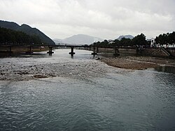
Shanjiang River in front of Xiaoyangfang, Xikou
|
|
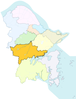
 Fenghua in Ningbo |
|
 Ningbo in China |
|
| Coordinates: 29°39′N 121°25′E / 29.650°N 121.417°ECoordinates: 29°39′N 121°25′E / 29.650°N 121.417°E | |
| Country |
|
| Province | Zhejiang |
| Sub-provincial city | Ningbo |
| Area | |
| • Total | 1,253 km2 (484 sq mi) |
| Population (2002) | |
| • Total | 480,000 |
| • Density | 380/km2 (990/sq mi) |
| Time zone | China Standard (UTC+8) |
| Postal code | 315500 |
| Area code(s) | 0574 |
| Website | www.FH.gov.cn |
| Fenghua District | |||||||||
| Chinese | 奉化 | ||||||||
|---|---|---|---|---|---|---|---|---|---|
| Postal | Fenghwa | ||||||||
|
|||||||||
| Transcriptions | |
|---|---|
| Standard Mandarin | |
| Hanyu Pinyin | Fènghuà |
| Wade–Giles | Feng4-hua4 |
![]() Fenghua (Chinese: 奉化; pinyin: Fènghuà; Wu: Fun-ho) is a district in the north of Zhejiang Province, China. It is under the jurisdiction of Ningbo prefecture-level city. The district and its administrative hinterlands has a population of over 480,000.
Fenghua (Chinese: 奉化; pinyin: Fènghuà; Wu: Fun-ho) is a district in the north of Zhejiang Province, China. It is under the jurisdiction of Ningbo prefecture-level city. The district and its administrative hinterlands has a population of over 480,000.
Fenghua is most famous for being the hometown of Generalissimo and President Chiang Kai-shek. Geographically, it is dominated by the Tiantai and Siming mountain ranges.
Fenghua was established as a county in the Tang dynasty, in the territory of Mingzhou. Its name means "Accepting Reform" and adopted during imperial times. During the Song dynasty, immigration from the north increased exponentially, peaking during the loss of northern China to the Jurchen Jin dynasty during the Jin–Song wars. In 1129, Fenghua was raided by Jurchen cavalry in pursuit of Emperor Gaozong. Local militia at Xiaowangmiao (蕭王廟) fought off the invaders.
...
Wikipedia
