Fallon, Nevada
| Fallon, Nevada | |
|---|---|
| City | |

Maine Street in Fallon
|
|
| Nickname(s): The Oasis of Nevada | |
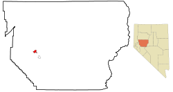
 Location of Fallon and Churchill County, Nevada |
|
| Location in the United States | |
| Coordinates: 39°28′22″N 118°46′44″W / 39.47278°N 118.77889°WCoordinates: 39°28′22″N 118°46′44″W / 39.47278°N 118.77889°W | |
| Country | United States |
| State | Nevada |
| County | Churchill |
| Area | |
| • Total | 3.65 sq mi (9.45 km2) |
| • Land | 3.63 sq mi (9.41 km2) |
| • Water | 0.02 sq mi (0.05 km2) |
| Elevation | 3,960 ft (1,207 m) |
| Population (2010) | |
| • Total | 8,606 |
| • Density | 2,370/sq mi (915.0/km2) |
| Time zone | Pacific (PST) (UTC-8) |
| • Summer (DST) | PDT (UTC-7) |
| ZIP codes | 89406, 89407, 89496 |
| Area code(s) | 775 |
| FIPS code | 32-24100 |
| GNIS feature ID | 0840412 |
| Website | www |
Fallon is a city in Churchill County, Nevada, United States. The population was 8,606 at time of the 2010 census. Fallon is the county seat of Churchill County and is located in the Lahontan Valley.
Fallon and Churchill County are mostly agricultural areas. Although the area is arid, approximately 50,000 acres (200 km2) of its pastureland are irrigated with water from the Truckee–Carson Irrigation District. The principal crop grown is alfalfa for livestock feed. The "Heart O' Gold" cantaloupes of Churchill County were once distributed across the United States, but are now grown mostly for consumption in Nevada.
The largest single employer in Fallon and Churchill County is Naval Air Station Fallon, a training airfield that has been the home of the U.S. Navy's Naval Strike and Air Warfare Center including the TOPGUN training program since 1996, when it was moved here from Naval Air Station Miramar with that Air Station transferred to the U.S. Marine Corps.
U.S. Highway 50 (east–west) and US 95 (north–south) intersect in Fallon. It is one of the towns on the so-called "Loneliest Highway in America", the stretch of US 50 across most of Nevada that is known for its remoteness. Eastbound travelers from Fallon must drive 110 miles (180 km) to find the next town, Austin.
The town and post office were established July 24, 1896 in a little shack of Michael Fallon.
Fallon is located in western Churchill County at the geographic coordinates 39°28′22″N 118°46′44″W / 39.47278°N 118.77889°W (39.472792, -118.778826). It is in the Lahontan Valley, a former lakebed into which flows the Carson River, which passes north of the city.
...
Wikipedia

