Daman and Diu Union Territory
|
Daman and Diu Damão e Diu (Portuguese) |
||
|---|---|---|
| Union territory | ||

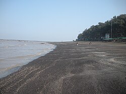
Devka Beach in Daman
|
||
|
||
 |
||
| Coordinates: 20°25′N 72°50′E / 20.42°N 72.83°ECoordinates: 20°25′N 72°50′E / 20.42°N 72.83°E | ||
| Country |
|
|
| Established | 30 May 1987 | |
| Capital | Daman | |
| Government | ||
| • Member of Parliament | Lalubhai Patel | |
| • Administrator | Praful Khoda Patel | |
| • Advisor to Administrator, Daman & Diu | S. S. Yadav, IAS | |
| • High Court | Bombay High Court | |
| Area | ||
| • Total | 112 km2 (43 sq mi) | |
| Area rank | 35th | |
| Population (2011) | ||
| • Total | 242,911 | |
| • Rank | 6th (among union territories) | |
| • Density | 2,200/km2 (5,600/sq mi) | |
| Languages | ||
| • Official |
Konkani Gujarati |
|
| Time zone | IST (UTC+5:30) | |
| ISO 3166 code | IN-DD | |
| No. of districts | 2 | |
| HDI |
|
|
| HDI Category | high | |
| Sex ratio | 1.61 ♂/♀ | |
| Website | www.daman.nic.in | |
| Population growth | |||
|---|---|---|---|
| Census | Pop. | %± | |
| 1951 | 49,000 |
—
|
|
| 1961 | 37,000 | -24.5% | |
| 1971 | 63,000 | 70.3% | |
| 1981 | 79,000 | 25.4% | |
| 1991 | 102,000 | 29.1% | |
| 2001 | 158,000 | 54.9% | |
| Source:Census of India | |||
Daman and Diu /dəˈmɑːn ... ˈdiːuː/ (![]() locally ) is a union territory in Western India. With an area of 112 km2, it is the smallest federal division of India on the mainland. The territory comprises two distinct regions Daman and Diu, geographically separated by the Gulf of Khambhat. The state of Gujarat and the Arabian Sea border the territory. A Portuguese colony since the 1500s, the territories were amalgamated in India in 1961 through a military conquest.
locally ) is a union territory in Western India. With an area of 112 km2, it is the smallest federal division of India on the mainland. The territory comprises two distinct regions Daman and Diu, geographically separated by the Gulf of Khambhat. The state of Gujarat and the Arabian Sea border the territory. A Portuguese colony since the 1500s, the territories were amalgamated in India in 1961 through a military conquest.
For over 450 years, the coastal enclaves of Daman (Portuguese: Damão) and Diu on the Arabian Sea coast were part of Portuguese India, along with Goa and Dadra and Nagar Haveli. Goa, Daman and Diu were incorporated into the Republic of India on December 19, 1961, by military conquest. Portugal did not recognise the Indian annexation of these territories until 1974.
...
Wikipedia

