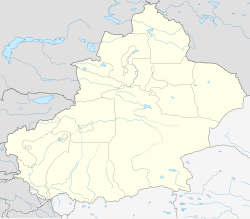
Dafdar
|
Dafdar 达布达尔 |
|
|---|---|
| Village | |
| 达布达尔乡 | |
| Location in Xinjiang | |
| Coordinates: 37°24′24″N 75°24′34″E / 37.40667°N 75.40944°ECoordinates: 37°24′24″N 75°24′34″E / 37.40667°N 75.40944°E | |
| Country | People's Republic of China |
| Province | Xinjiang |
| Prefecture | Kashgar Prefecture |
| County | Tashkurgan Tajik Autonomous County |
| Area | |
| • Total | 28 km2 (11 sq mi) |
| Time zone | China Standard Time (UTC+8) |
Dafdar or Daftar (Chinese: 达佈达尔, pinyin: Dábùdá'ĕr) is a village in the disputed Taghdumbash Pamir located in Tashkurgan Tajik Autonomous County, Xinjiang Uyghur Autonomous Region, China. It is inhabited by Wakhis. The village lies at an altitude of 3,400 m above sea level, just to the east of the Karakoram Highway.
During the Qing Dynasty the Chinese claimed suzerainty over the area but permitted the Mir of Hunza to administer the region in return for a tribute. The Mir erected a cairn in the village to evidence his control. The villagers stopped paying tribute to Hunza in 1937.
It is the northernmost point claimed by India as a part of the state Jammu and Kashmir.
...
Wikipedia

