Cricqueville-en-Bessin
| Cricqueville-en-Bessin | |
|---|---|

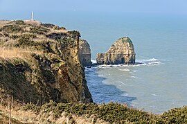
La Pointe du Hoc
|
|
| Coordinates: 49°22′38″N 1°00′01″W / 49.3771°N 1.0002°WCoordinates: 49°22′38″N 1°00′01″W / 49.3771°N 1.0002°W | |
| Country | France |
| Region | Normandy |
| Department | Calvados |
| Arrondissement | Bayeux |
| Canton | Isigny-sur-Mer |
| Intercommunality | Isigny Grandcamp |
| Government | |
| • Mayor (2008–2014) | Frédéric Pain |
| Area1 | 8.55 km2 (3.30 sq mi) |
| Population (2008)2 | 186 |
| • Density | 22/km2 (56/sq mi) |
| Time zone | CET (UTC+1) |
| • Summer (DST) | CEST (UTC+2) |
| INSEE/Postal code | 14204 / 14450 |
| Elevation | 0–39 m (0–128 ft) (avg. 50 m or 160 ft) |
|
1 French Land Register data, which excludes lakes, ponds, glaciers > 1 km² (0.386 sq mi or 247 acres) and river estuaries. 2Population without double counting: residents of multiple communes (e.g., students and military personnel) only counted once. |
|
1 French Land Register data, which excludes lakes, ponds, glaciers > 1 km² (0.386 sq mi or 247 acres) and river estuaries.
Cricqueville-en-Bessin is a commune in the Calvados department in the Normandy region in northwestern France.
The municipality takes its name from its deep-water creek that forms a natural harbor, from Crycavilla.
Just outside Cricqueville, the United States Army Air Forces established an airfield shortly after D-Day on 9 June 1944, just three days after the Allied landings in France. The airfield was one of the first established in the liberated area of Normandy. Known as Advanced Landing Ground "A-2" (Cricqueville), it was used from early June though September 1944. After the Americans moved east into Central France, the airfield was dismantled and the land returned to agricultural use.
...
Wikipedia


