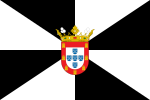
Ceuta
|
Ceuta Arabic: سبتة (Sabtah)
|
|||
|---|---|---|---|
| Autonomous city | |||

Ceuta, as seen from Monte Hacho
|
|||
|
|||
 Location of Ceuta within Spain |
|||
| Coordinates: 35°53′18″N 5°18′56″W / 35.88833°N 5.31556°WCoordinates: 35°53′18″N 5°18′56″W / 35.88833°N 5.31556°W | |||
| Country | Spain | ||
| Autonomous city | Ceuta | ||
| First settled | 5th century BC | ||
| End of Muslim rule | 14 August 1415 | ||
| Ceded to Spain | 1 January 1668 | ||
| Autonomy status | 14 March 1995 | ||
| Founded by | Berbers or Carthaginians | ||
| Government | |||
| • Type | Autonomous city | ||
| • Body | Council of Government | ||
| • Mayor-President | Juan Jesús Vivas (PP) | ||
| Area | |||
| • Total | 18.5 km2 (7.1 sq mi) | ||
| • Land | 18.5 km2 (7.1 sq mi) | ||
| Elevation | 10 m (30 ft) | ||
| Highest elevation | 349 m (1,145 ft) | ||
| Population (2011) | |||
| • Total | 82,376 | ||
| • Density | 4,500/km2 (12,000/sq mi) | ||
| Demonym(s) | Ceutan ceutí (es) |
||
| Time zone | CET (UTC+1) | ||
| • Summer (DST) | CEST (UTC+2) | ||
| ISO 3166-2 | ES-CE | ||
| Postal code | 51001–51005 | ||
| Official language | Spanish | ||
| Parliament | Cortes Generales | ||
| Congress | 1 deputy (out of 350) | ||
| Senate | 2 senators (out of 264) | ||
| Website | www |
||
Ceuta (assimilated pronunciation /ˈsjuːtə/ SEW-tə, also /ˈseɪʊtə/ SAY-uu-tə;Spanish: [ˈθeuta]; Arabic: سبتة, Sabtah) is an 18.5-square-kilometre (7.1 sq mi) Spanish autonomous city located on the north coast of Africa, sharing a western border with Morocco. Separated from the Iberian peninsula by the Strait of Gibraltar, Ceuta lies along the boundary between the Mediterranean Sea and the Atlantic Ocean. Ceuta, along with the Spanish exclave Melilla, is one of nine populated Spanish territories in Africa and one of two populated territories on mainland Africa. It was part of Cádiz province until 14 March 1995 when the city's Statute of Autonomy was passed.
...
Wikipedia


