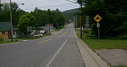
Caroga, New York
| Caroga, New York | |
|---|---|
| Town | |

Hamlet of Caroga Lake
|
|
| Location within the state of New York | |
| Coordinates: 43°8′36″N 74°29′24″W / 43.14333°N 74.49000°WCoordinates: 43°8′36″N 74°29′24″W / 43.14333°N 74.49000°W | |
| Country | United States |
| State | New York |
| County | Fulton |
| Government | |
| • Type | Town Council |
| • Town Supervisor | James K. Selmser (R) |
| • Town Council |
Members' List
|
| Area | |
| • Total | 54.3 sq mi (140.6 km2) |
| • Land | 50.6 sq mi (131.1 km2) |
| • Water | 3.7 sq mi (9.5 km2) |
| Elevation | 1,637 ft (499 m) |
| Population (2010) | |
| • Total | 1,205 |
| • Density | 24/sq mi (9.2/km2) |
| Time zone | Eastern (EST) (UTC-5) |
| • Summer (DST) | EDT (UTC-4) |
| ZIP code | 12032 |
| Area code(s) | 518 |
| FIPS code | 36-12573 |
| GNIS feature ID | 0978794 |
| Website | www |
Caroga is a town in Fulton County, New York, USA. The population was 1,205 at the 2010 census. The town was named after a local creek.
Caroga is in the northern part of the county, northwest of Gloversville and Johnstown.
The town was first settled around 1783.
The town was created in 1842 from parts of the towns of Bleecker, Johnstown, and Stratford.
The name of the town is an altered spelling of Garoga [Creek], which flows south out of the town towards the Mohawk River.
The industry of the early town was based on lumber and tanning. By 1890 the population was 624.
According to the United States Census Bureau, the town has a total area of 54.3 square miles (140.6 km2), of which 50.6 square miles (131.1 km2) is land and 3.7 square miles (9.5 km2), or 6.73%, is water.
Caroga is inside the Adirondack Park. The north town line is the border of Hamilton County.
New York State Route 10 is a north-south highway in Caroga. It leads north to Piseco Lake in the town of Arietta and south to Canajoharie on the Mohawk River. New York State Route 29A is an east-west highway intersecting NY-10 near Pine Lake and then running southward as a conjoined highway to Caroga Lake. NY 29A leads southeast to Gloversville and west to Salisbury. New York State Route 10A branches off NY-10 to the southeast near Bradtville, providing a route to Johnstown, the Fulton County seat.
...
Wikipedia

