Camp Verde, Arizona
| Camp Verde, Arizona | |
|---|---|
| Town | |

"World's Largest Kokopelli" in Camp Verde
|
|
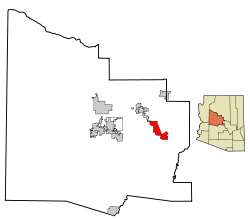
 Location in Yavapai County and the state of Arizona |
|
| Location in the United States | |
| Coordinates: 34°34′0″N 111°51′22″W / 34.56667°N 111.85611°WCoordinates: 34°34′0″N 111°51′22″W / 34.56667°N 111.85611°W | |
| Country | United States |
| State | Arizona |
| County | Yavapai |
| Government | |
| • Mayor | Charlie German |
| Area | |
| • Total | 42.6 sq mi (110.3 km2) |
| • Land | 42.6 sq mi (110.2 km2) |
| • Water | 0.0 sq mi (0.0 km2) |
| Elevation | 3,147 ft (959 m) |
| Population (2010) | |
| • Total | 10,873 |
| • Estimate (2014) | 11,097 |
| • Density | 222.0/sq mi (85.7/km2) |
| Time zone | MST (UTC-7) |
| ZIP code | 86322 |
| Area code(s) | 928 |
| FIPS code | 04-09690 |
| Website | Town of Camp Verde |
Camp Verde (Yavapai: ʼMatthi:wa; Western Apache: Gambúdih) is a town in Yavapai County, Arizona, United States. According to the 2010 census, the population of the city is 10,873.
The town hosts an annual corn festival in July, sponsored and organized by Hauser and Hauser Farms. Other annual festivals include Fort Verde Days (October); the Pecan, Wine and Antiques Festival (February); and the Crawdad Festival (June).
The 42.6 sq mi (110 km2) town is intersected by I-17, extending 8 miles (13 km) to the West and 10 miles (16 km) to the East of the interstate. Three freeway exits provide local access: Exits 285, 287, and 289. The Town's Historic Downtown is approximately 1-mile (1.6 km) from I-17 and contains a grocery store, physician facilities, shopping, dining, historical museum, Fort Verde State Historic Park, chamber of commerce/visitor center and town offices. Camp Verde is located at 34°34′0″N 111°51′22″W / 34.56667°N 111.85611°W (34.566713, -111.856194).
According to the United States Census Bureau, the town has a total area of 42.6 square miles (110 km2), of which, 42.6 square miles (110 km2) of it is land and 0.02% is water. It is in the Verde River valley. To the southwest lie the Black Hills mountain range. Camp Verde is surrounded by Prescott National Forest. The Mogollon Rim is just north of the town and forms the southwestern edge of the large, geologically ancient Colorado Plateau.
...
Wikipedia

