Bukit Timah Planning Area
| Bukit Timah | |||||||
|---|---|---|---|---|---|---|---|
| Planning Area and HDB Estate | |||||||
| Other transcription(s) | |||||||
| • Chinese | 武吉知马 | ||||||
| • Pinyin | Wǔjí Zhīmǎ | ||||||
| • Hokkien POJ | Bú-kiat Ti-bé | ||||||
| • Malay | Bukit Timah | ||||||
| • Tamil | புக்கித் திமா | ||||||
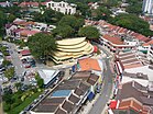
From top left to right: National Junior College, Ngee Ann Polytechnic, The Chinese High School Clock Tower Building, Aerial view of the Bukit Timah portion of Holland Village, Bukit Timah Railway Station
|
|||||||
| Location of Bukit Timah within Singapore | |||||||
| Coordinates: 1°19′45.88″N 103°48′7.48″E / 1.3294111°N 103.8020778°E | |||||||
| Country |
|
||||||
| Region |
|
||||||
| CDCs | |||||||
| Town councils |
|
||||||
| Constituencies | |||||||
| Government | |||||||
| • Mayors |
Central Singapore CDC North West CDC South West CDC |
||||||
| • Members of Parliament |
Holland-Bukit Timah GRC Jurong GRC Tanjong Pagar GRC |
||||||
| Area | |||||||
| • Total | 17.53 km2 (6.77 sq mi) | ||||||
| Population (2015) | |||||||
| • Total | 74,470 | ||||||
| • Density | 4,200/km2 (11,000/sq mi) | ||||||
| Demonym(s) |
Official
Colloquial
|
||||||
| Ethnic groups | |||||||
| • Chinese | 64,150 | ||||||
| • Malays | 760 | ||||||
| • Indians | 3,650 | ||||||
| • Others | 5,910 | ||||||
| Postal districts | 10, 11, 21 | ||||||
| Dwelling units | 2,423 | ||||||
Central Singapore CDC
North West CDC
South West CDC
Holland-Bukit Timah GRC
Jurong GRC
Tanjong Pagar GRC
Official
Colloquial
Bukit Timah (Chinese: 武吉知马, Tamil: புக்கித் திமா), often abbreviated as Bt Timah, is a planning area and residential estate located in the Central Region of Singapore. Bukit Timah lies roughly 10 kilometres (6.2 mi) from the Central Business District, bordering the Central Water Catchment to the north, Bukit Panjang to the northwest, Queenstown to the south, Tanglin to the southeast, Clementi to the southwest, Novena to the east and Bukit Batok to the west.
With little government-funded public housing developments in the area, Bukit Timah has one of the highest densities of private housing out of any other planning areas in the country. Compared to other places located in the outskirts of the city, residential properties in Bukit Timah are far more expensive.
Bukit Timah, which literally means "tin hill" in Malay, was already identified on the 1828 map by Frankin and Jackson as Bukit Timah. The hill in question was depicted on the map towards the northwest as two hills at the eastern source of the Kranji River.
...
Wikipedia


