Bodrogiensis County
| Bács-Bodrog County Comitatus Bacsiensis et Bodrogiensis (Latin) Bács-Bodrog vármegye (Hungarian) Komitat Batsch-Bodrog (German) Бачко-бодрошка жупанија (Serbian) |
|||||
|
County of the Kingdom of Hungary in Austria-Hungary |
|||||
|
|||||
|
Coat of arms |
|||||
| Capital |
Zombor (present-day Sombor) 45°46′N 19°7′E / 45.767°N 19.117°ECoordinates: 45°46′N 19°7′E / 45.767°N 19.117°E |
||||
| History | |||||
| • | Established | 18th century | |||
| • | Treaty of Trianon | 4 June 1920 | |||
| • | County recreated | 1941 | |||
| • | Abolished | 1944 1920 | |||
| Area | |||||
| • | 1910 | 10,362 km2(4,001 sq mi) | |||
| Population | |||||
| • | 1910 | 812,385 | |||
| Density | 78.4 /km2 (203.1 /sq mi) | ||||
| Today part of |
Serbia Hungary |
||||
Coat of arms
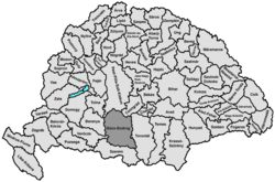
Bács-Bodrog County (Hungarian: Bács-Bodrog vármegye, German: Komitat Batsch-Bodrog, Serbian: Bačko-bodroška županija) was the administrative county (comitatus) of the Kingdom of Hungary from the 18th century to 1920. Its territory is currently in northern Serbia (western Vojvodina) and southern Hungary. The capital of the county was Zombor (present-day Sombor).
The county was named after two older counties: Bács and Bodrog. Bács county was named after a town of Bács (present-day Bač) and the Bodrog county was named after a historical town of Bodrog (which was located near present-day Bački Monoštor), which itself was named after a Slavic tribe Abodrites (or Bodrići in Slavic) that inhabited this area in the Middle Ages. The Abodrites were originally from northwest Germany, but after their homeland fell to the Germans, some had moved to Pannonia.
Bács-Bodrog county shared borders with several other counties of the Kingdom of Hungary: Baranya, Pest-Pilis-Solt-Kiskun, Csongrád, Torontál, Syrmia, and Virovitica (the latter two counties were part of autonomous Kingdom of Croatia-Slavonia). The river Danube formed its western and southern border. The river Tisza formed its eastern border, down to its confluence with the Danube. Its area was 10,362 km² around 1910.
...
Wikipedia


