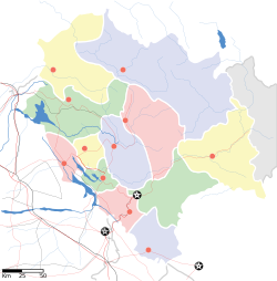
Bir Tibetan Colony
|
Bir Tibetan Colony Chowgan |
|
|---|---|
| village | |
| Location in Himachal Pradesh, India | |
| Coordinates: 32°01′N 76°26′E / 32.02°N 76.43°ECoordinates: 32°01′N 76°26′E / 32.02°N 76.43°E | |
| Country |
|
| Region | North India |
| State | Himachal Pradesh |
| District | Kangra |
| Tehsil | Baijnath |
| Elevation | 1,404 m (4,606 ft) |
| Languages | |
| • Official | Hindi, English |
| Time zone | IST (UTC+5:30) |
| PIN | 176 077 |
| Telephone code | 91-1894 |
| Website | birhp |
Bir Tibetan Colony is a Tibetan refugee settlement in the Himalayan village of Chowgan on the outskirts of the town of Bir, in the state of Himachal Pradesh in northern India.
Bir Tibetan Colony was established in the early 1960s by Chokling Rinpoche following the exile of the Dalai Lama and other refugees from Tibet.
The Tibetan Colony houses several Tibetan monasteries (representing the Nyingma, Kagyu, and Sakya traditions), a Tibetan handicraft center, a Tibetan Children's Village school (Suja), a branch of the Tibetan Medical and Astrological Institute (Men-Tsee-Khang), a medical clinic, and the Deer Park Institute. It is also home to a number of shops, cafés, and guest houses.
Bir Tibetan Colony is located in the western half of the village of Chowgan, on the southwestern edge of the town of Bir, in the Tehsil (administrative subdivision) of Baijnath, in the District of Kangra, in the Indian state of Himachal Pradesh.
Bir Tibetan Colony is located east-southeast of Dharamshala and is three hours by bus from Dharamshala. It is situated 6 km south of the popular paragliding destination of billing, on the way to the Thamsar Pass leading to Bara Bhangal.
Geologically, Bir is situated in the Dhauladhar Range of the foothills of the Indian Himalayas.
The nearest railway station is Ahju, on the narrow-gauge line running between Pathankot and Jogindernagar via Kangra.
...
Wikipedia


