Beverwijk
| Beverwijk | |||
|---|---|---|---|
| Municipality | |||

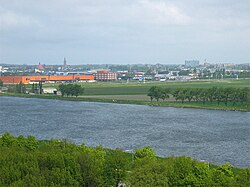
Beverwijk as seen from the North Sea Canal
|
|||
|
|||
 Location in North Holland |
|||
| Coordinates: 52°29′N 4°39′E / 52.483°N 4.650°ECoordinates: 52°29′N 4°39′E / 52.483°N 4.650°E | |||
| Country | Netherlands | ||
| Province | North Holland | ||
| Government | |||
| • Body | Municipal council | ||
| • Mayor | Han van Leeuwen (D66) | ||
| Area | |||
| • Total | 20.09 km2 (7.76 sq mi) | ||
| • Land | 18.34 km2 (7.08 sq mi) | ||
| • Water | 1.75 km2 (0.68 sq mi) | ||
| Elevation | 2 m (7 ft) | ||
| Population (May 2014) | |||
| • Total | 40,049 | ||
| • Density | 2,184/km2 (5,660/sq mi) | ||
| Demonym(s) | Beverwijker | ||
| Time zone | CET (UTC+1) | ||
| • Summer (DST) | CEST (UTC+2) | ||
| Postcode | 1940–1949 | ||
| Area code | 251 | ||
| Website | www |
||
Beverwijk (Dutch pronunciation: [ˌbeːvərˈʋɛi̯k]) is a municipality and a town in the Netherlands, in the province of North Holland. The town is located about 20 kilometres (12 mi) northwest of Amsterdam in the Randstad metropolitan area, north of the North Sea Canal very close to the North Sea coast. A railway tunnel and two motorway tunnels cross the canal between Beverwijk and the nearby city of Haarlem on the south bank.
Around 1640, a town called Beverwyck was founded in the Dutch colony of New Netherland. This town's modern name is Albany, New York.
The municipality of Beverwijk consists of two cores, Beverwijk proper and Wijk aan Zee, 5 km (3.1 mi) to the west, right on the coast.
The name Beverwijk comes from Bedevaartswijk, meaning "pilgrimage neighbourhood". The town formed at the Saint Agatha Church which was a pilgrimage location in the Middle Ages. Allegedly Agatha of Sicily appeared there in the 9th century to a virgin from Velsen who was fleeing from the Count of Kennemerland.
In 1276 Beverwijk was granted market rights by Floris V, and in 1298 it was granted city rights by John I, both Counts of Holland.
During the 17th century wealthy merchants from Amsterdam built their estates, such as Huize Akerendam, Huize Westerhout, and Huize Scheijbeeck, in the scenic dunes surrounding Beverwijk.
Prior to the reclamation of the IJ Bay, the narrowest point in the North Holland peninsula was at Beverwijk. Therefore, a defensive line was built there in 1800 following the Battle of Castricum in 1799.
...
Wikipedia


