Atacama Desert
| Atacama Desert | |
| Desert | |
|
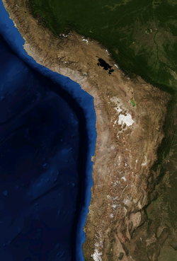
Atacama by NASA World Wind
|
|
| Country | Chile |
|---|---|
| Area | 105,000 km2 (40,541 sq mi) |
| Biome | Desert |
|
Map of the Atacama Desert. The area most commonly defined as Atacama is yellow. In orange are the outlying arid areas of southern Peru, Altiplano, Puna de Atacama and Norte Chico.
|
|
Coordinates: 24°30′S 69°15′W / 24.500°S 69.250°W
The Atacama Desert (Spanish: Desierto de Atacama) is a plateau in South America, covering a 1,000-kilometre (600 mi) strip of land on the Pacific coast, west of the Andes mountains. It is the driest non-polar desert in the world. According to estimates, the Atacama Desert proper occupies 105,000 square kilometres (41,000 sq mi), or 128,000 square kilometres (49,000 sq mi) if the barren lower slopes of the Andes are included. Most of the desert is composed of stony terrain, salt lakes (salares), sand, and felsic lava that flows towards the Andes.
Geographically, the aridity of the Atacama is explained by it being situated between two mountain chains (the Andes and the Chilean Coast Range) of sufficient height to prevent moisture advection from either the Pacific or the Atlantic Oceans, a two-sided rain shadow.
According to the World Wide Fund for Nature, the Atacama Desert ecoregion occupies a continuous strip for nearly 1,600 km along the narrow coast of the northern third of Chile, from near Arica (18°24' S) southward to near La Serena (29°55' S). The National Geographic Society considers the coastal area of southern Peru to be part of the Atacama Desert and also includes the deserts south of the Ica Region in Peru.
...
Wikipedia


