Arica
| Arica | ||||||
|---|---|---|---|---|---|---|
| City and Commune | ||||||
 |
||||||
|
||||||
| Nickname(s): "City of the eternal spring" | ||||||
| Coordinates (city): 18°29′S 70°20′W / 18.483°S 70.333°WCoordinates: 18°29′S 70°20′W / 18.483°S 70.333°W | ||||||
| Country |
|
|||||
| Region |
|
|||||
| Province | Arica | |||||
| Founded | 1541 | |||||
| Government | ||||||
| • Type | Municipality | |||||
| • Alcalde | Salvador Urrutia (PRO) | |||||
| Area | ||||||
| • Total | 4,799.4 km2 (1,853.1 sq mi) | |||||
| Elevation | 2 m (7 ft) | |||||
| Population (2012) | ||||||
| • Total | 210,216 | |||||
| • Density | 44/km2 (110/sq mi) | |||||
| • Urban | 175,441 | |||||
| • Rural | 9,827 | |||||
| Demonym(s) | Arican | |||||
| Sex | ||||||
| • Male | 91,742 | |||||
| • Female | 93,526 | |||||
| Time zone | CLT (UTC−4) | |||||
| • Summer (DST) | CLST (UTC−3) | |||||
| Postal code | 1000000 | |||||
| Area code(s) | +56 58 | |||||
| Climate | BWh | |||||
| Website | Official website (Spanish) | |||||
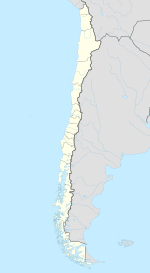
Arica (Spanish pronunciation: [aˈɾika]; English /əˈriːkə/ uh-REE-kuh) is a commune and a port city with a population of 196,590 in the Arica Province of northern Chile's Arica y Parinacota Region. It is Chile's northernmost city, being located only 18 km (11 mi) south of the border with Peru. The city is the capital of both the Arica Province and the Arica and Parinacota Region. Arica is located at the bend of South America's western coast known as the Arica Bend or Arica Elbow. At the location of the city two lush valleys that dissect the Atacama Desert converge: Azapa and Lluta. These valleys provides fruit for export.
Arica is an important port for a large inland region of South America. The city serves a free port for Bolivia and manages a substantial part of that country's trade. In addition it is the end station of the Bolivian oil pipeline beginning in Oruro. The city's strategic position is enhanced by being next to the Pan-American Highway, being connected to both Tacna in Peru and La Paz in Bolivia by railroad and being served by an international airport.
...
Wikipedia


