Alameda County
| Alameda County, California | |||||||
|---|---|---|---|---|---|---|---|
| County | |||||||
| County of Alameda | |||||||
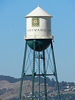
Images, from top down, left to right: Looking southwest across Lake Merritt in Oakland, Sather Tower on the UC Berkeley campus, a water tower in Hayward, Lake Elizabeth in Fremont, Pleasanton sign
|
|||||||
|
|||||||
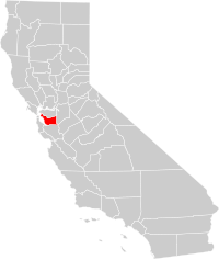
 Location in the state of California |
|||||||
 California's location in the United States |
|||||||
| Country | |||||||
| State |
|
||||||
| Metropolitan area | San Francisco–Oakland–Hayward | ||||||
| Incorporated | March 25, 1853 | ||||||
| County seat | Oakland | ||||||
| Largest city | Oakland (population and area) | ||||||
| Government | |||||||
| • Body | Alameda County Board of Supervisors | ||||||
| Area | |||||||
| • Total | 821 sq mi (2,130 km2) | ||||||
| • Land | 739 sq mi (1,910 km2) | ||||||
| • Water | 82 sq mi (210 km2) | ||||||
| Highest elevation | 3,843 ft (1,171 m) | ||||||
| Population (April 1, 2010) | |||||||
| • Total | 1,510,271 | ||||||
| • Estimate (2015) | 1,638,215 | ||||||
| • Density | 1,800/sq mi (710/km2) | ||||||
| Time zone | Pacific Time Zone (UTC-8) | ||||||
| • Summer (DST) | Pacific Daylight Time (UTC-7) | ||||||
| Area codes | 510, 925 | ||||||
| FIPS code | 06-001 | ||||||
| Website | www |
||||||
Alameda County (/ˌæləˈmiːdə/ AL-ə-MEE-də) is a county in the state of California in the United States. As of the 2010 census, the population was 1,510,271, making it the 7th-most populous county in the state. Its county seat is Oakland. Alameda County is included in the San Francisco Bay Area, occupying much of the East Bay region.
The county was formed on March 25, 1853, from a large portion of Contra Costa County and a smaller portion of Santa Clara County.
The Spanish word alameda means "a place where poplar trees grow," a name originally given to the Arroyo de la Alameda (Poplar Grove Creek). The willow and sycamore trees along the banks of the river reminded the early explorers of a road lined with trees, also known as an alameda.
The county seat at the time it was formed was located at Alvarado, now part of Union City. In 1856 it was moved to San Leandro, where the county courthouse was destroyed by the devastating 1868 quake on the Hayward Fault. The county seat was then re-established in the town of Brooklyn from 1872-1875. Brooklyn is now part of Oakland, which has been the county seat since 1873.
...
Wikipedia


