Hayward, California
| Hayward, California | ||
|---|---|---|
| City | ||
![Historic Hunt's Cannery water tower[1][2]](http://upload.wikimedia.org/wikipedia/commons/thumb/a/ab/Hayward_water_tower%2C_California.jpg/250px-Hayward_water_tower%2C_California.jpg)
Historic Hunt's Cannery water tower
|
||
|
||
| Motto: Heart of the Bay | ||
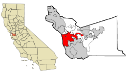
 The city of Hayward highlighted within Alameda County |
||
| Location in the United States | ||
| Coordinates: 37°40′08″N 122°04′51″W / 37.668820°N 122.080796°WCoordinates: 37°40′08″N 122°04′51″W / 37.668820°N 122.080796°W | ||
| Country |
|
|
| State |
|
|
| County | Alameda | |
| Incorporated | March 11, 1876 | |
| Government | ||
| • Type | Council-Manager | |
| • Mayor | Barbara Halliday | |
| • State Senate | Bob Wieckowski (D) | |
| • Assemblymember | Bill Quirk (D) | |
| • U. S. rep. | Eric Swalwell (D) | |
| Area | ||
| • City | 63.748 sq mi (165.108 km2) | |
| • Land | 45.323 sq mi (117.386 km2) | |
| • Water | 18.425 sq mi (47.721 km2) 28.9% | |
| Elevation | 105 ft (32 m) | |
| Population (2014) | ||
| • City | 149,392 | |
| • Estimate (January 1, 2016) | 158,985 | |
| • Rank |
3rd in Alameda County 37th in California |
|
| • Density | 3,296/sq mi (1,273/km2) | |
| • Metro | 7,468,390 | |
| Time zone | Pacific (UTC−8) | |
| • Summer (DST) | PDT (UTC−7) | |
| ZIP codes | 94540–94546, 94552, 94557 | |
| Area code | 510 | |
| FIPS code | 06-33000 | |
| GNIS feature IDs | 277607, 2410724 | |
| Flower | Carnation | |
| Website | www |
|
Hayward (/ˈheɪwərd/; formerly, Haywards, Haywards Station, and Haywood) is a city located in Alameda County, California in the East Bay subregion of the San Francisco Bay Area. With a 2014 population of 149,392, Hayward is the sixth largest city in the Bay Area and the third largest in Alameda County. Hayward was ranked as the 37th most populous municipality in California. It is included in the San Francisco-Oakland-Fremont Metropolitan Statistical Area by the US Census. It is located primarily between Castro Valley and Union City, and lies at the eastern terminus of the San Mateo-Hayward Bridge. The city was devastated early in its history by the 1868 Hayward earthquake. From the early 20th century until the beginning of the 1980s, Hayward's economy was dominated by its now defunct food canning and salt production industries.
Human habitation of the greater East Bay, including Hayward, dates from at least 4000 B.C. The most recent pre-European inhabitants of the Hayward area were the Native American Ohlone people.
In the 19th century, the land that is now Hayward became part of Rancho San Lorenzo, a Spanish land grant to Guillermo Castro in 1841. The site of his home was on the former El Camino Viejo, or Castro Street (now Mission Boulevard) between C and D Streets, but the structure was severely damaged in the 1868 Hayward earthquake, with the Hayward Fault running directly under its location. Most of the city's structures were destroyed in the earthquake, the last major earthquake on the fault. In 1930, that site was chosen for the construction of the City Hall, which served the city until 1969.
...
Wikipedia


