Castro Valley, California
| Castro Valley | |
|---|---|
| CDP | |

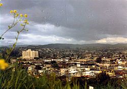
Castro Valley, ca. 1970
|
|
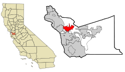
 Location of Castro Valley within Alameda County, California. |
|
| Location in the United States | |
| Coordinates: 37°41′39″N 122°05′11″W / 37.69417°N 122.08639°WCoordinates: 37°41′39″N 122°05′11″W / 37.69417°N 122.08639°W | |
| Country |
|
| State |
|
| County | Alameda |
| Government | |
| • State Senate | Bob Wieckowski (D) |
| • State Assembly | Bill Quirk (D) |
| • U. S. Congress | Eric Swalwell (D) |
| Area | |
| • Total | 16.919 sq mi (43.819 km2) |
| • Land | 16.635 sq mi (43.083 km2) |
| • Water | 0.284 sq mi (0.735 km2) 1.68% |
| Elevation | 161 ft (49 m) |
| Population (2010) | |
| • Total | 61,388 |
| • Density | 3,690.3/sq mi (1,424.8/km2) |
| Time zone | PST (UTC-8) |
| • Summer (DST) | PDT (UTC-7) |
| ZIP codes | 94546, 94552 |
| Area code(s) | 510 |
| FIPS code | 06-11964 |
| GNIS feature IDs | 1658237, 2407987 |
| Site of the first public school in Castro Valley | |
|---|---|
| Location | 19200 Redwood Rd., Castro Valley, California |
| Coordinates | 37°42′24″N 122°04′26″W / 37.7067°N 122.073983°W |
| Reference no. | 776 |
Castro Valley is a census-designated place (CDP) in Alameda County, California, United States. As of the 2000 census, it is the fifth most populous unincorporated area in California and the twenty-third most populous in the United States. The population was 61,388 at the 2010 census.
Castro Valley is named after Don Guillermo Castro, who was a soldier in the Mexican army and a rancher.
First known for chicken ranches, Castro Valley eventually became a bedroom community.
Before the arrival of European settlers the area was settled by the Chocheño (also spelled Chochenyo or Chocenyo) subdivision of the Ohlone Native Americans.
With the arrival of Europeans, Castro Valley was part of the land granted to Mission San Jose in 1797. The area Castro Valley now occupies was part of the extensive colony of New Spain in what was the state of Alta California.
Castro Valley was part of the original 28,000 acre (110 km²) land grant given to Castro, called Rancho San Lorenzo. This land grant included Hayward, San Lorenzo, and Castro Valley, including Crow Canyon, Cull Canyon, and Palomares Canyons. Castro had a gambling habit and had to sell off portions of his land to pay gambling debts. The last of his holding was sold in a sheriff's sale in 1864 to Faxon Atherton for $400,000.
Atherton (after whom the city of Atherton is named) in turn began selling off his portion in smaller parcels. Two gentlemen named Cull (the namesake of Cull Canyon) and Luce bought some 2,400 acres (10 km²) and began running a steam-operated saw mill in Redwood Canyon. The Jensen brothers also bought land from Atherton in 1867.
...
Wikipedia

