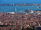
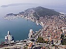
Adriatic coast
| Adriatic Sea | |
|---|---|

Map of the Adriatic Sea
|
|
| Location | Europe |
| Coordinates | 43°N 15°E / 43°N 15°ECoordinates: 43°N 15°E / 43°N 15°E |
| Type | Sea |
| Primary inflows | Adige, Bojana, Drin, Krka, Neretva, Po, Soča |
| Primary outflows | Ionian Sea |
| Catchment area | 235,000 km2 (91,000 sq mi) |
| Basin countries |
Coastal: Albania, Greece, Italy, Croatia, Montenegro, Slovenia, and Bosnia-Herzegovina Non-coastal: Serbia,Macedonia, Kosovo, Switzerland and France (drainage basins for inflow rivers) |
| Max. length | 800 km (500 mi) |
| Max. width | 200 km (120 mi) |
| Surface area | 138,600 km2 (53,500 sq mi) |
| Average depth | 252.5 m (828 ft) |
| Max. depth | 1,233 m (4,045 ft) |
| Water volume | 35,000 km3 (2.8×10¹⁰ acre·ft) |
| Residence time | 3.4±0.4 years |
| Salinity | 38–39 PSU |
| Shore length1 | 3,739.1 km (2,323.4 mi) |
| Max. temperature | 24 °C (75 °F) |
| Min. temperature | 9 °C (48 °F) |
| Islands | Over 1300 |
| Settlements | Bari, Venice, Trieste, Split, Pescara, Šibenik, Rimini, Rijeka, Durrës, Ancona, Zadar, Vlorë, Brindisi, Dubrovnik |
| 1 Shore length is not a well-defined measure. | |
|
|
Rank | City | Country | Region/County | Population (urban) | |
|---|---|---|---|---|---|---|
| 1 | Bari | Italy | Apulia | 320,475 | ||
| 2 | Venice | Italy | Veneto | 270,884 | ||
| 3 | Trieste | Italy | Friuli-Venezia Giulia | 205,535 | ||
| 4 | Split | Croatia | Split-Dalmatia | 178,102 | ||
| 5 | Durrës | Albania | Durrës | 175,110 | ||
| 6 | Rimini | Italy | Emilia-Romagna | 142,579 | ||
| 7 | Rijeka | Croatia | Primorje-Gorski Kotar | 128,384 | ||
| 8 | Pescara | Italy | Abruzzo | 123,103 | ||
| 9 | Ancona | Italy | Marche | 101,210 | ||
| 10 | Pesaro | Italy | Marche | 95,800 | ||
| Sources: 2011 Croatian census, Italian National Institute of Statistics (2011), 2011 Albanian Census | ||||||
The Adriatic Sea /ˌeɪdriˈætᵻk/ is a body of water separating the Italian Peninsula from the Balkan peninsula and the Apennine Mountains from the Dinaric Alps and adjacent ranges. The Adriatic is the northernmost arm of the Mediterranean Sea, extending from the Strait of Otranto (where it connects to the Ionian Sea) to the northwest and the Po Valley. The countries with coasts on the Adriatic are Albania, Bosnia and Herzegovina, Croatia, Greece, Italy, Montenegro and Slovenia. The Adriatic contains over 1,300 islands, mostly located along its eastern, Croatian, coast. It is divided into three basins, the northern being the shallowest and the southern being the deepest, with a maximum depth of 1,233 metres (4,045 ft). The Otranto Sill, an underwater ridge, is located at the border between the Adriatic and Ionian Seas. The prevailing currents flow counterclockwise from the Strait of Otranto, along the eastern coast and back to the strait along the western (Italian) coast. Tidal movements in the Adriatic are slight, although larger amplitudes are known to occur occasionally. The Adriatic's salinity is lower than the Mediterranean's because the Adriatic collects a third of the fresh water flowing into the Mediterranean, acting as a dilution basin. The surface water temperatures generally range from 30 °C (86 °F) in summer to 12 °C (54 °F) in winter, significantly moderating the Adriatic Basin's climate.
...
Wikipedia


