2014 North Indian Ocean cyclone season
| 2014 North Indian Ocean cyclone season |

Season summary map
|
| Seasonal boundaries |
| First system formed |
January 4, 2014 |
| Last system dissipated |
November 8, 2014 |
| Strongest storm |
|
| Name |
Nilofar |
| • Maximum winds |
205 km/h (125 mph)
(3-minute sustained) |
| • Lowest pressure |
950 hPa (mbar) |
| Seasonal statistics |
| Depressions |
8 |
| Deep depressions |
5 |
| Cyclonic storms |
3 |
| Severe cyclonic storms |
2 |
| Very severe cyclonic storms |
2 |
| Total fatalities |
183 |
| Total damage |
At least $3.4 billion (2014 USD) |
| Related articles |
|
|
North Indian Ocean tropical cyclone seasons
2012, 2013, 2014, 2015, 2016
|
| Depression (IMD) |
| Tropical storm (SSHWS) |
|
|
| Duration |
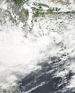
January 4 – January 7 |
| Peak intensity |
45 km/h (30 mph) (3-min) 1004 hPa (mbar) |
| Depression (IMD) |
|
|
| Duration |
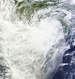
May 21 – May 23 |
| Peak intensity |
45 km/h (30 mph) (3-min) 1000 hPa (mbar) |
| Cyclonic storm (IMD) |
| Tropical storm (SSHWS) |
|
|
| Duration |
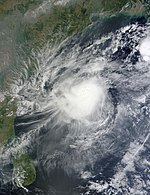
June 10 – June 14 |
| Peak intensity |
85 km/h (50 mph) (3-min) 986 hPa (mbar) |
| Depression (IMD) |
|
|
| Duration |
July 21 – July 23 |
| Peak intensity |
45 km/h (30 mph) (3-min) 988 hPa (mbar) |
| Deep depression (IMD) |
|
|
| Duration |
August 4 – August 7 |
| Peak intensity |
55 km/h (35 mph) (3-min) |
| Extremely severe cyclonic storm (IMD) |
| Category 4 tropical cyclone (SSHWS) |
|
|
| Duration |
October 7 – October 14 |
| Peak intensity |
185 km/h (115 mph) (3-min) 950 hPa (mbar) |
| Extremely severe cyclonic storm (IMD) |
| Category 4 tropical cyclone (SSHWS) |
|
|
| Duration |
October 25 – October 31 |
| Peak intensity |
205 km/h (125 mph) (3-min) 950 hPa (mbar) |
| Deep depression (IMD) |
| Tropical storm (SSHWS) |
|
|
| Duration |
November 5 – November 8 |
| Peak intensity |
55 km/h (35 mph) (3-min) 1000 hPa (mbar) |
The 2014 North Indian Ocean cyclone season was an event in the annual cycle of tropical cyclone formation. The season included two Very Severe Cyclonic Storms, both in October, and one other named cyclonic storm. Cyclone Hudhud is estimated to have caused US$3.4 billion in damage across eastern India, and more than 100 deaths.
The scope of this article is limited to the Indian Ocean in the Northern Hemisphere, east of the Horn of Africa and west of the Malay Peninsula. There are two main seas in the North Indian Ocean — the Arabian Sea to the west of the Indian subcontinent, abbreviated ARB by the India Meteorological Department (IMD); and the Bay of Bengal to the east, abbreviated BOB by the IMD. The official Regional Specialized Meteorological Centre in this basin is the India Meteorological Department (IMD), while the Joint Typhoon Warning Center releases unofficial advisories. On average, four to six storms form in this basin every season.
Under the influence of an active intertropical convergence zone, the season got off to one of its earliest starts on record, with a depression developing over the Andaman Sea during January 4. Over the next couple of days the system moved westwards and made landfall on Sri Lanka, where it weakened into an area of low pressure. Over the next few months the basin remained quiet, before the precursor cyclonic circulation to Depression BOB 02 developed during May 18. As the cyclonic circulation developed it helped the southwest monsoon, advance into the Andaman Sea and parts of the Bay of Bengal, before it developed into a depression during May 21. The depression was short lived and weakened into a remnant low, over the Bay of Bengal during May 23. The southwest monsoon was subsequently delayed by six days setting in over the Indian state of Kerala and eventually moved over the state during June 6. Over the next few days the monsoon set in further over the Bay of Bengal, while it was enhanced over the Arabian Sea by the formation of Cyclonic Storm Nanauk. By June 18, the monsoon covered most of the North Indian Ocean and parts of Gujarat, Konkan & Goa, Odisha, Jharkhand, Bihar and Gangetic West Bengal.
...
Wikipedia


