2009 North Indian Ocean cyclone season
| 2009 North Indian Ocean cyclone season | |
|---|---|

Season summary map
|
|
| Seasonal boundaries | |
| First system formed | April 14, 2009 |
| Last system dissipated | December 16, 2009 |
| Strongest storm | |
| Name | Aila |
| • Maximum winds | 110 km/h (70 mph) (3-minute sustained) |
| • Lowest pressure | 968 hPa (mbar) |
| Seasonal statistics | |
| Depressions | 8 |
| Deep depressions | 6 |
| Cyclonic storms | 4 |
| Severe cyclonic storms | 1 |
| Very severe cyclonic storms | 0 |
| Super cyclonic storms | 0 |
| Total fatalities | 409 direct, 12 indirect, ~8,208 missing |
| Total damage | $618.4 million (2009 USD) |
| Related articles | |
| Cyclonic storm (IMD) | |
| Tropical storm (SSHWS) | |
| Duration | April 14 – April 17 |
|---|---|
| Peak intensity | 75 km/h (45 mph) (3-min) 996 hPa (mbar) |
| Severe cyclonic storm (IMD) | |
| Category 1 tropical cyclone (SSHWS) | |
| Duration | May 23 – May 26 |
|---|---|
| Peak intensity | 110 km/h (70 mph) (3-min) 968 hPa (mbar) |
| Depression (IMD) | |
| Duration | June 23 – June 24 |
|---|---|
| Peak intensity | 45 km/h (30 mph) (3-min) 998 hPa (mbar) |
| Depression (IMD) | |
| Duration | June 25 – June 25 |
|---|---|
| Peak intensity | 45 km/h (30 mph) (3-min) 996 hPa (mbar) |
| Deep depression (IMD) | |
| Duration | July 20 – July 21 |
|---|---|
| Peak intensity | 55 km/h (35 mph) (3-min) 988 hPa (mbar) |
| Cyclonic storm (IMD) | |
| Tropical storm (SSHWS) | |
| Duration | September 4 – September 7 |
|---|---|
| Peak intensity | 70 km/h (45 mph) (3-min) 988 hPa (mbar) |
| Cyclonic storm (IMD) | |
| Tropical storm (SSHWS) | |
| Duration | November 4 – November 11 |
|---|---|
| Peak intensity | 85 km/h (50 mph) (3-min) 988 hPa (mbar) |
| Cyclonic storm (IMD) | |
| Tropical storm (SSHWS) | |
| Duration | December 10 – December 16 |
|---|---|
| Peak intensity | 85 km/h (50 mph) (3-min) 996 hPa (mbar) |
The 2009 North Indian Ocean cyclone season was an event in the annual cycle of tropical cyclone formation. The North Indian Ocean cyclone season has no official bounds, but cyclones tend to form between April and December, with peaks in May and November. These dates conventionally delimit the period of each year when most tropical cyclones form in the northern Indian Ocean.
The scope of this article is limited to the Indian Ocean in the Northern Hemisphere, east of the Horn of Africa and west of the Malay Peninsula. There are two main seas in the North Indian Ocean — the Arabian Sea to the west of the Indian subcontinent, abbreviated ARB by the India Meteorological Department (IMD); and the Bay of Bengal to the east, abbreviated BOB by the IMD.
The official Regional Specialized Meteorological Centre in this basin is the India Meteorological Department (IMD), while the Joint Typhoon Warning Center releases unofficial advisories. The tropical cyclone scale for this basin is detailed on the right. On average, 4 to 6 storms form in this basin every season.
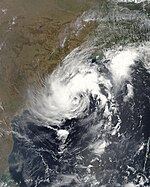
On April 13, an area of shower and thunderstorms became slightly organized over the central Bay of Bengal. Later that day, an area of low pressure developed underneath the convection as the system developed. Weak banding features also formed around the periphery of the storm. By April 14, deep convection persisted around the center of circulation; following the development the RSMC in New Delhi, India designated the system as Depression BOB 01. Following further development, the Joint Typhoon Warning Center (JTWC) issued a Tropical Cyclone Formation Alert (TCFA) as they anticipated the system to develop into a tropical storm. Early the next morning the JTWC reported that the depression had intensified into a tropical storm and designated it as Cyclone 01B. The storm tracked towards the west-northwest due to a mid-level ridge over India. Later that morning RSMC New Delhi reported that the depression had intensified into a deep depression and reported it was expected to intensify into Cyclonic Storm Bijli. Around 1500 UTC, the RSMC New Delhi upgraded the system to a cyclonic storm and gave it the name Bijli. All four ports in Orissa were placed on high alert due to rough seas produced by the storm. A Local Cautionary Signal Number Three was issued for the Gopalpur, Puri, Paradeep and Chandabali ports. On April 16, the storm turned towards the northeast, paralleling the eastern coast of India. Around 0600 UTC, RSMC New Delhi reported that Bijli had reached its peak intensity with winds of 75 km/h (45 mph 3-minute winds). Early on April 17, RSMC New Delhi reported that Bijli had weakened to a deep depression as it moved northwest. Later, RSMC New Delhi downgraded the deep depression to a depression. Late on April 17, RSMC New Delhi reported that Depression ex-Bijli had made landfall near Chittagong, Bangladesh and had rapidly become an area of low pressure over Bangladesh. Maximum winds of 30 knots (56 km/hr) were reported in Cox's Bazar and 3 people were killed in Bangladesh. That night, the JTWC issued their final advisory on Tropical Cyclone 01B as it rapidly weakened over Bangladesh and Myanmar.
...
Wikipedia


