2006–07 Australian region cyclone season
| 2006–07 Australian region cyclone season |

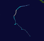
Season summary map
|
| Seasonal boundaries |
| First system formed |
30 December 2006 |
| Last system dissipated |
18 May 2007 |
| Strongest storm |
|
| Name |
George |
| • Maximum winds |
205 km/h (125 mph) |
| • Lowest pressure |
902 hPa (mbar) |
| Seasonal statistics |
| Tropical lows |
8 |
| Tropical cyclones |
5 |
| Severe tropical cyclones |
3 |
| Total fatalities |
3 |
| Total damage |
Unknown |
| Related articles |
|
|
Australian region tropical cyclone seasons
2004–05, 2005–06, 2006–07, 2007–08, 2008–09
|
| Tropical low (Australian scale) |
| Tropical storm (SSHWS) |
|
|
| Duration |
30 December – 5 January |
| Peak intensity |
85 km/h (50 mph) (10-min) 982 hPa (mbar) |
| Category 2 tropical cyclone (Australian scale) |
| Tropical storm (SSHWS) |
|
|
| Duration |
5 February – 7 February |
| Peak intensity |
95 km/h (60 mph) (10-min) 985 hPa (mbar) |
| Tropical low (Australian scale) |
|
|
| Duration |
5 February – 8 February |
| Peak intensity |
85 km/h (50 mph) (10-min) 995 hPa (mbar) |
| Tropical low (Australian scale) |
|
|
| Duration |
19 February – 20 February (exited basin) |
| Peak intensity |
75 km/h (45 mph) (10-min) 1000 hPa (mbar) |
| Tropical low (Australian scale) |
|
|
| Duration |
2 March – 5 March |
| Peak intensity |
75 km/h (45 mph) (10-min) 990 hPa (mbar) |
| Category 5 severe tropical cyclone (Australian scale) |
| Category 3 tropical cyclone (SSHWS) |
|
|
| Duration |
3 March – 10 March |
| Peak intensity |
205 km/h (125 mph) (10-min) 902 hPa (mbar) |
| Category 3 severe tropical cyclone (Australian scale) |
| Category 1 tropical cyclone (SSHWS) |
|
|
| Duration |
3 March – 12 March |
| Peak intensity |
130 km/h (80 mph) (10-min) 958 hPa (mbar) |
| Category 3 severe tropical cyclone (Australian scale) |
| Category 3 tropical cyclone (SSHWS) |
|
|
| Duration |
24 March – 28 March |
| Peak intensity |
155 km/h (100 mph) (10-min) 948 hPa (mbar) |
| Category 1 tropical cyclone (Australian scale) |
| Tropical depression (SSHWS) |
|
|
| Duration |
16 May – 18 May |
| Peak intensity |
75 km/h (45 mph) (10-min) 990 hPa (mbar) |
The 2006–07 Australian region cyclone season was a below average tropical cyclone season. It began on 1 November 2006 and ended on 30 April 2007; however, Tropical Cyclone Pierre formed on 17 May, after the official end date. The regional tropical cyclone operational plan also defines a tropical cyclone year separately from a tropical cyclone season, which runs from 1 July 2006 to 30 June 2007.
Tropical cyclones in this area are monitored by four Tropical Cyclone Warning Centres (TCWCs): the Australian Bureau of Meteorology in Perth, Darwin, and Brisbane; and TCWC Port Moresby in Papua New Guinea.
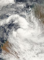
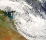
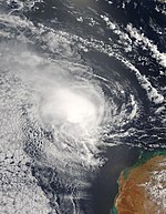
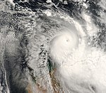
An area of increased thunderstorm activity south of Indonesia was first spotted on 29 December 2006, when the Bureau of Meteorology (BOM) noted that a weak tropical low could develop in the area. Late on 31 December, the BOM began issuing advisories on the tropical low. The Joint Typhoon Warning Center issued a Tropical Cyclone Formation Alert on the system early on 2 January 2007, and the Tropical Cyclone Warning Centre in Perth upgraded it to a tropical cyclone later that morning, naming it Isobel. The JTWC followed suit and designated the system Tropical Cyclone 07S. Isobel was downgraded to a tropical low shortly after landfall over the Eighty Mile Beach on 3 January and advisories were stopped at 0600 UTC that morning. The remnants of Isobel merged with a deep low pressure system near the southern coast of Western Australia, dumping 100 mm of torrential rain, in what was dubbed a "perfect storm". The extratropical system halted mining operations and unleashed winds of up to 120 km/h.
...
Wikipedia


