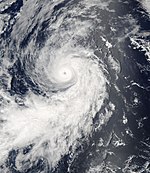
2004 Pacific hurricane season
| 2004 Pacific hurricane season |

Season summary map
|
| Seasonal boundaries |
| First system formed |
May 22, 2004 |
| Last system dissipated |
October 26, 2004 |
| Strongest storm |
|
| Name |
Javier |
| • Maximum winds |
150 mph (240 km/h)
(1-minute sustained) |
| • Lowest pressure |
930 mbar (hPa; 27.46 inHg) |
| Seasonal statistics |
| Total depressions |
17 official, 1 unofficial |
| Total storms |
12 |
| Hurricanes |
6 |
Major hurricanes
(Cat. 3+) |
3 |
| Total fatalities |
0 |
| Total damage |
Unknown |
| Related articles |
|
|
Pacific hurricane seasons
2002, 2003, 2004, 2005, 2006
|
| Tropical storm (SSHWS) |
|
|
| Duration |
May 22 – May 24 |
| Peak intensity |
60 mph (95 km/h) (1-min) 997 mbar (hPa) |
| Tropical depression (SSHWS) |
|
|
| Duration |
July 2 – July 3 |
| Peak intensity |
35 mph (55 km/h) (1-min) 1007 mbar (hPa) |
| Tropical depression (SSHWS) |
|
|
| Duration |
July 5 – July 5 |
| Peak intensity |
30 mph (45 km/h) (1-min) 1007 mbar (hPa) |
| Tropical storm (SSHWS) |
|
|
| Duration |
July 12 – July 15 |
| Peak intensity |
65 mph (100 km/h) (1-min) 991 mbar (hPa) |
| Category 1 hurricane (SSHWS) |
|
|
| Duration |
July 19 – July 25 |
| Peak intensity |
85 mph (140 km/h) (1-min) 981 mbar (hPa) |
| Category 3 hurricane (SSHWS) |
|
|
| Duration |
July 26 – August 1 |
| Peak intensity |
120 mph (195 km/h) (1-min) 957 mbar (hPa) |
| Tropical depression (SSHWS) |
|
|
| Duration |
August 1 – August 2 |
| Peak intensity |
30 mph (45 km/h) (1-min) 1008 mbar (hPa) |
| Tropical storm (SSHWS) |
|
|
| Duration |
August 19 – August 24 |
| Peak intensity |
70 mph (110 km/h) (1-min) 989 mbar (hPa) |
| Category 1 hurricane (SSHWS) |
|
|
| Duration |
August 23 – August 26 |
| Peak intensity |
85 mph (140 km/h) (1-min) 979 mbar (hPa) |
The 2004 Pacific hurricane season was notable in that no tropical cyclone of at least tropical storm intensity moved ashore, an unusual occurrence. The season officially began on May 15 in the eastern Pacific, and on June 1 in the central Pacific; it officially ended in both basins on November 30. These dates conventionally delimit the period during each year when a majority of tropical cyclones form. Activity throughout the year fell slightly below the long-term average, with 12 named storms, 6 hurricanes, and 3 major hurricanes. The season was reflected by an Accumulated Cyclone Energy (ACE) index of 71 units.
Impact throughout the season was minimal and no deaths were recorded. In early August, the remnants of Hurricane Darby aided in localized heavy rainfall in Hawaii, causing minor street and stream flooding; coffee and macadamia trees were damaged as well. In early September, Hurricane Howard resulted in significant flooding across Baja California Peninsula that damaged agricultural land and 393 homes. Large swells also resulted in about 1,000 lifeguard rescues in California. In mid-September, Javier caused three fishermen to go missing and helped alleviate a multi-year drought across the Southwest United States. It produced record rainfall in the state of Wyoming. In mid- to late October, Tropical Storm Lester and Tropical Depression Sixteen-E caused localized flooding; the latter may have produced a tornado near Culiacán, Mexico.
In January 2004, the Servicio Meteorológico Nacional (SMN) released their first prediction for tropical cyclone activity throughout the Northeast Pacific. Based on a Neutral El Niño Southern Oscillation (ENSO), a total of 15 named storms, 6 hurricanes, and 3 major hurricanes was forecast. These values were slightly altered in May to 14 named storms, 7 hurricanes, and 2 major hurricanes, and again in August to 13 named storms, 6 hurricanes, and 3 major hurricanes.
...
Wikipedia


