1995 Pacific typhoon season
| 1995 Pacific typhoon season | |
|---|---|

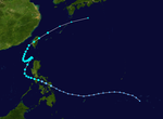
Season summary map
|
|
| Seasonal boundaries | |
| First system formed | January 7, 1995 |
| Last system dissipated | December 31, 1995 |
| Strongest storm | |
| Name | Angela |
| • Maximum winds | 215 km/h (130 mph) (10-minute sustained) |
| • Lowest pressure | 910 hPa (mbar) |
| Seasonal statistics | |
| Total depressions | 47 |
| Total storms | 24 |
| Typhoons | 8 |
| Super typhoons | 5 |
| Total fatalities | 1,314 |
| Total damage | $1.21 billion (1995 USD) |
| Related articles | |
| Tropical depression (SSHWS) | |
| Duration | January 7 (entered basin) – January 8 |
|---|---|
| Peak intensity | 55 km/h (35 mph) (1-min) 1000 hPa (mbar) |
| Tropical storm (JMA) | |
| Tropical storm (SSHWS) | |
| Duration | April 27 – May 4 |
|---|---|
| Peak intensity | 65 km/h (40 mph) (10-min) 998 hPa (mbar) |
| Tropical storm (JMA) | |
| Tropical storm (SSHWS) | |
| Duration | June 1 – June 8 |
|---|---|
| Peak intensity | 75 km/h (45 mph) (10-min) 996 hPa (mbar) |
| Tropical depression (JMA) | |
| Tropical storm (SSHWS) | |
| Duration | June 4 – June 9 |
|---|---|
| Peak intensity | 55 km/h (35 mph) (10-min) 1002 hPa (mbar) |
| Typhoon (JMA) | |
| Category 3 typhoon (SSHWS) | |
| Duration | July 16 – July 25 |
|---|---|
| Peak intensity | 140 km/h (85 mph) (10-min) 950 hPa (mbar) |
| Tropical depression (JMA) | |
| Tropical storm (SSHWS) | |
| Duration | July 25 – July 28 |
|---|---|
| Peak intensity | 55 km/h (35 mph) (10-min) 1004 hPa (mbar) |
| Severe tropical storm (JMA) | |
| Category 1 typhoon (SSHWS) | |
| Duration | July 28 – August 2 |
|---|---|
| Peak intensity | 100 km/h (65 mph) (10-min) 980 hPa (mbar) |
| Severe tropical storm (JMA) | |
| Category 1 typhoon (SSHWS) | |
| Duration | August 7 – August 13 |
|---|---|
| Peak intensity | 110 km/h (70 mph) (10-min) 985 hPa (mbar) |
| Tropical storm (JMA) | |
| Tropical storm (SSHWS) | |
| Duration | August 17 – August 20 |
|---|---|
| Peak intensity | 85 km/h (50 mph) (10-min) 990 hPa (mbar) |
The 1995 Pacific typhoon season occurred all year round, unusual in that most tropical cyclones tend to form in the northwestern Pacific Ocean between May and November.
The scope of this article is limited to the Pacific Ocean, north of the equator and west of the international date line. Storms that form east of the date line and north of the equator are called hurricanes; see 1995 Pacific hurricane season. Tropical storms formed in the entire west Pacific basin were assigned a name by the Joint Typhoon Warning Center. Tropical depressions in this basin have the "W" suffix added to their number. Tropical depressions that enter or form in the Philippine area of responsibility are assigned a name by the Philippine Atmospheric, Geophysical and Astronomical Services Administration or PAGASA. This can often result in the same storm having two names.
31 tropical cyclones formed this year in the Western Pacific, of which 26 became tropical storms. 8 storms reached typhoon intensity, five of them achieving super typhoon strength.
A circulation started to develop and spawned a tropical disturbance near the equator but east of the International Dateline on December 30, 1994. The system remained stationery for several days until it finally gathered some warm waters and low to moderate windshear on January 5. With that, the JTWC classified it as Tropical Depression 01W as it crossed the basin early on January 7. Moving northeastwards, it entered an area of high vertical windshear, cool waters and weak convection and dissipated on January 9.
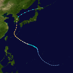
Tropical Depression 05W formed on July 15 and was named Faye the next day as it intensified into a tropical storm. On July 19, Faye became the first typhoon of the season, tied for the second latest date of the first typhoon with 1977, only behind Otto of 1998. It tracked northwestward and eventually reached a peak of 120 mph (205 km/h) 1-min winds and a minimum pressure of 950 millibars. Faye turned northward, and after weakening slightly it hit the south coast of South Korea on the 23rd, before accelerating east-northeastwards and becoming extratropical. 16 people were reported dead, with moderate damage from flooding.
...
Wikipedia


