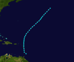
1888 Atlantic hurricane season
| 1888 Atlantic hurricane season |

Season summary map
|
| Seasonal boundaries |
| First system formed |
June 16, 1888 |
| Last system dissipated |
November 25, 1888 |
| Strongest storm |
|
| Name |
Three |
| • Maximum winds |
125 mph (205 km/h)
(1-minute sustained) |
| • Lowest pressure |
945 mbar (hPa; 27.91 inHg) |
| Seasonal statistics |
| Total storms |
9 |
| Hurricanes |
6 |
Major hurricanes
(Cat. 3+) |
2 |
| Total fatalities |
924 |
| Total damage |
$2.7 million (1888 USD) |
|
|
Atlantic hurricane seasons
1886, 1887, 1888, 1889, 1890
|
| Category 1 hurricane (SSHWS) |
|
|
| Duration |
June 16 – June 18 |
| Peak intensity |
80 mph (130 km/h) (1-min) 985 mbar (hPa) |
| Tropical storm (SSHWS) |
|
|
| Duration |
July 4 – July 6 |
| Peak intensity |
60 mph (95 km/h) (1-min) ≤1008 mbar (hPa) |
| Category 3 hurricane (SSHWS) |
|
|
| Duration |
August 14 – August 24 (extratropical on August 22)
|
| Peak intensity |
125 mph (205 km/h) (1-min) 945 mbar (hPa) |
| Category 3 hurricane (SSHWS) |
|
|
| Duration |
August 31 – September 8 |
| Peak intensity |
125 mph (205 km/h) (1-min) ≤972 mbar (hPa) |
| Tropical storm (SSHWS) |
|
|
| Duration |
September 6 – September 11 |
| Peak intensity |
60 mph (95 km/h) (1-min) 999 mbar (hPa) |
| Category 1 hurricane (SSHWS) |
|
|
| Duration |
September 23 – September 26 |
| Peak intensity |
80 mph (130 km/h) (1-min) 985 mbar (hPa) |
| Category 2 hurricane (SSHWS) |
|
|
| Duration |
October 8 – October 12 |
| Peak intensity |
110 mph (175 km/h) (1-min) 970 mbar (hPa) |
| Tropical storm (SSHWS) |
|
|
| Duration |
November 1 – November 8 |
| Peak intensity |
60 mph (95 km/h) (1-min) |
| Category 2 hurricane (SSHWS) |
|
|
| Duration |
November 17 – November 25 |
| Peak intensity |
100 mph (155 km/h) (1-min) ≤982 mbar (hPa) |
The 1888 Atlantic hurricane season ran through the summer and the first half of fall in 1888. In the 1888 Atlantic season there were two tropical storms, four hurricanes, and two major hurricanes. However, in the absence of modern satellite and other remote-sensing technologies, only storms that affected populated land areas or encountered ships at sea are known, so the actual total could be higher. An undercount bias of zero to six tropical cyclones per year between 1851 and 1885 and zero to four per year between 1886 and 1910 has been estimated.
The first tropical storm and first hurricane of the season formed by 00:00 UTC on June 16 in the northwestern Gulf of Mexico, centered about 200 miles (322 km) southeast of Galveston Island, Texas. (Due to sparse observations, the system may have developed prior to this time, but was not detected.) The cyclone moved west-northwestward and quickly strengthened, becoming a hurricane late on June 16. It reached its peak intensity of 80 miles per hour (129 km/h) early on June 17. Around 06:00 UTC on June 17, the hurricane made landfall southwest of Bay City, Texas, over the eastern end of East Matagorda Bay. Turning to the northwest after landfall, it quickly degenerated into a tropical storm, gradually turning northward over time. By 06:00 UTC on June 18, it weakened into a tropical depression, and just 12 hours later it lost its identity near Waco, Texas.
In Texas, the cyclone produced heavy rain, peaking at 6.4 inches (163 mm) over a 16-hour period at Galveston. The highest measured winds reached 54 mph (87 km/h) in the city. Along the coast of Texas, the lowest measured pressure was 29.69 inches of mercury (1,005 mb) at Corpus Christi, about 120 miles (193 km) southwest of the landfall location. The Atlantic hurricane reanalysis project estimated that the minimum central pressure in the storm was likely close to 985 millibars (29.09 inHg) at the time of landfall. Operationally, the U.S. Signal Corps—predecessor to the U.S. Weather Bureau (now the National Weather Service)—did not classify the system as an area of low pressure, and it did not appear in the June 1888 track map of cyclones in the Monthly Weather Review, the official publication of the Signal Corps. However, as early as June 17 the New York Times noted that a moderate storm was apparently approaching Texas.
...
Wikipedia


