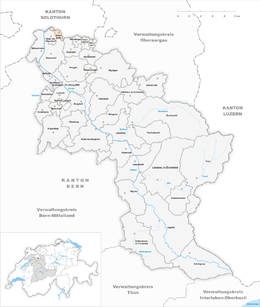
Zielebach
| Zielebach | ||
|---|---|---|
|
||
| Coordinates: 47°10′N 7°35′E / 47.167°N 7.583°ECoordinates: 47°10′N 7°35′E / 47.167°N 7.583°E | ||
| Country | Switzerland | |
| Canton | Bern | |
| District | Emmental | |
| Area | ||
| • Total | 1.92 km2 (0.74 sq mi) | |
| Elevation | 460 m (1,510 ft) | |
| Population (Dec 2015) | ||
| • Total | 325 | |
| • Density | 170/km2 (440/sq mi) | |
| Postal code | 4564 | |
| SFOS number | 0556 | |
| Surrounded by | Bätterkinden, Biberist (SO), Gerlafingen (SO), Koppigen, Obergerlafingen (SO), Utzenstorf, Wiler bei Utzenstorf | |
| Website |
http://www.zielebach.ch SFSO statistics |
|
Zielebach is a municipality in the administrative district of Emmental in the canton of Bern in Switzerland.
Zielebach is first mentioned in 1320 as Zielebach.
During the Middle Ages, the village was owned by the Counts of Kyburg. At some time before 1331, Johann von Aarburg acquired rights to the land and the Zwing und Bann rights. However, a decade later, in 1341 he gave the village and all rights to St. Urban's Abbey. The city of Bern gained rights in the village, until in 1514, they incorporated the village into the Bernese bailiwick of Landshut. It remained part of the bailiwick, until the Act of Mediation in 1803 dissolved all the old bailiwicks and Zielebach became part of the new District of Fraubrunnen.
During the 19th century an iron works opened in the nearby village of Gerlafingen. In 1813, the Emme canal connected the municipalities and Zielebach began to support the factory at Gerlafingen.
Zielebach has an area of 1.92 km2 (0.74 sq mi). Of this area, 0.77 km2 (0.30 sq mi) or 40.1% is used for agricultural purposes, while 0.93 km2 (0.36 sq mi) or 48.4% is forested. Of the rest of the land, 0.17 km2 (0.066 sq mi) or 8.9% is settled (buildings or roads), 0.02 km2 (4.9 acres) or 1.0% is either rivers or lakes and 0.02 km2 (4.9 acres) or 1.0% is unproductive land.
Of the built up area, industrial buildings made up 1.6% of the total area while housing and buildings made up 4.2% and transportation infrastructure made up 2.1%. Out of the forested land, all of the forested land area is covered with heavy forests. Of the agricultural land, 24.0% is used for growing crops and 14.6% is pastures, while 1.6% is used for orchards or vine crops. Of the water in the municipality, 0.5% is in lakes and 0.5% is in rivers and streams.
...
Wikipedia


