Bätterkinden
| Bätterkinden | ||
|---|---|---|

Bätterkinden village church
|
||
|
||
| Coordinates: 47°8′N 7°32′E / 47.133°N 7.533°ECoordinates: 47°8′N 7°32′E / 47.133°N 7.533°E | ||
| Country | Switzerland | |
| Canton | Bern | |
| District | Emmental | |
| Government | ||
| • Mayor |
Gemeindepräsident Rosmarie Habegger-Scheidegger SVP/UDC (as of 2009) |
|
| Area | ||
| • Total | 10.17 km2 (3.93 sq mi) | |
| Elevation | 473 m (1,552 ft) | |
| Population (Dec 2015) | ||
| • Total | 3,186 | |
| • Density | 310/km2 (810/sq mi) | |
| Postal code | 3315 | |
| SFOS number | 0533 | |
| Localities | Bätterkinden, Kräiligen, Alp, Holzhäusern, Berchtoldshof, Buuchi, Studenacher, Löffelhof, Neumatt, Niedermatt, Rütti | |
| Surrounded by | Aefligen, Fraubrunnen, Limpach, Schalunen, Utzenstorf, Wiler bei Utzenstorf, and Zielebach (Canton of Bern); Aetingen, Biberist, Gerlafingen, Küttigkofen, Kyburg-Buchegg, Lohn-Ammannsegg, and Lüterkofen (Canton of Solothurn) | |
| Website |
www SFSO statistics |
|
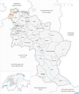
Bätterkinden is a municipality in the administrative district of Emmental in the canton of Bern in Switzerland. It is about 20 km (12 mi) north of Bern.
Bätterkinden is first mentioned in 1261 as Beturchingen.
During the High Middle Ages there was a settlement on the Zwingherrenhubel. By 1261, Bätterkinden village was part of the Kyburg Amt of Utzenstorf. In 1406, the Kyburgs pledged Bätterkinden to Heinrich Ringoltingen to repay some of their debts. He combined Bätterkinden and Utzenstorf into the Herrschaft of Landshut. In 1510, Bern acquired Bätterkinden and four years later the rest of the Herrschaft of Landshut.
Following the 1798 French invasion, Bätterkinden became part of the Helvetic Republic district of Burgdorf. After the Act of Mediation in 1803, it was transferred to the Fraubrunnen district. The village was destroyed in a fire and rebuilt in 1882. The new Zelgli district was built in 1979.
The village church was first mentioned in 1275. The church, along with a farm in Gächliwil, was originally owned by the Herrschaft of Buchegg. In 1399 the church and its estates were given to the hospice in Bern. In 1595 the church was administered by the bailiff in Landshut. The old church was replaced in 1664 by a new building.
During the 18th and 19th centuries, farmers began to grow potatoes and sugar beets and raise cattle in addition to grain which they had traditionally raised. A dairy was built in Bätterkinden in 1848 and in Krailigen in 1867 for the new dairy farmers. An agricultural cooperative was founded in 1897 to support the farmers. The village was once on the Bern-Solothurn-Basel highway and had a toll station in Krailigen, but now it is bypassed by the major transportation routes. While the Bern-Solothurn railway station and a bridge over the Emme river provide local transportation, very little industry settled in the village. A wood pulp factory opened in 1865 and converted into a paper mill in 1893 before closing in 1930. In 1921 a gravel factory opened and it converted into a concrete factory in 1974. A metal parts factory opened in 1949. While some of the residents work in local industry or agriculture, over two-thirds of workers, in 1990, commuted to jobs in Bern. The municipal secondary school was founded in 1846 as a private school.
...
Wikipedia


